Oh, I do like to be beside the seaside – Barry delights
Oh, I do like to be beside the seaside – Barry delights
Written by Dr Rhoda Ballinger, SEP Chair
An opportunity to introduce our visiting visual artist, Heather, to an old friend from Barry, resulted in my May Walk becoming a pleasant stroll from Barry Island to Porthkerry along the Vale of Glamorgan coastline. Although this was a rather familiar, relatively local stretch of coast for me, sharing the experience with Heather and researching the walk afterwards revealed many fascinating aspects of this coast – it’s certainly much more than just the home of Gavin and Stacey! I hope you’ll agree!
Barry Island beach nostalgia
As the two-carriage train clanked its way slowly into the station at Barry Island on a grey, overcast Thursday in late spring, it was hard to imagine the bustling excitement of families armed with bucket and spades and other beach paraphernalia on sunny summer weekend trains. Walking through the deserted and somewhat tired-looking Fun Fair to the seafront, even the brightly coloured dinosaur didn’t instil too much of the Barrybados vibe which has attracted generations of South Walians to this iconic location.
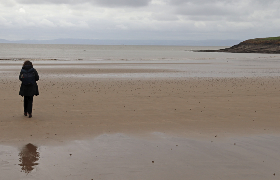
Whitmore Bay looking towards the N Devon coast
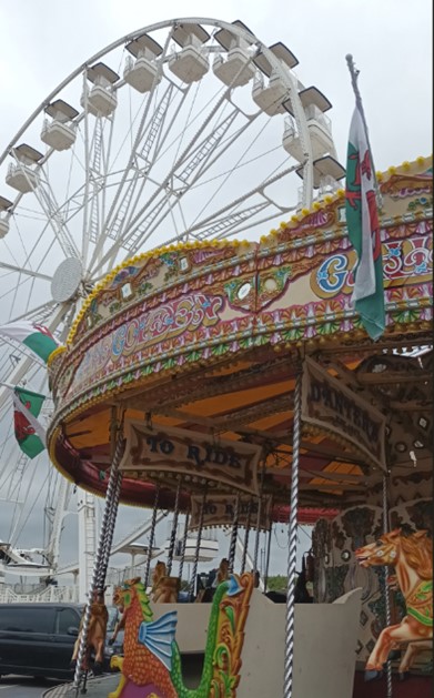
Barry Island amusement park
Meeting with Heather in one of the many seafront cafes for brunch, there was a little more buzz; however, it still was quite a challenge to explain the significance of Barry Island to my guest. Heather looked slightly bemused as I outlined the history of the famous Majestic/Butlins Holiday Camp which had over many decades provided a unforgettable, unique holiday experience for hundreds of thousands of those ‘of modest means’ and which, along with other similar camps elsewhere along the British coast, had created a public nostalgia which had inspired the popular TV sitcom Hi-de-Hi. Now the site of a Bovis Homes housing development on Nell’s Point, I was struggling to recall my memories of thirty years ago, when the derelict holiday camp with its rows and rows of white, flat-roofed chalets which dominated the Whitmore Bay seascape.
With a slight break in the clouds and a falling tide, we ventured onto the wide expanse of sandy beach which understandably remains such an attraction at weekends. The view across the Inner Bristol Channel to the Somerset and North Devon coasts always inspires and the gentle, relaxing sound of the sea lapping at the water’s edge is such a welcome break from the hustle and bustle of the promenade. However, frequent tannoy announcements periodically break the peace to remind you that this is an urban beach which must kept clean and tidy. The frequent instructions to dispose of your litter responsibly, alongside daily cleaning by local groups, does seem to be working, although the recent erroneous closure of the beach here due a malfunctioning water quality monitoring system has probably not instilled much public confidence (BBC news article). Unfortunately, the slightly brownish, turbid waters of the Estuary, are also frequently incorrectly interpreted by visitors as being dirty – clearly there’s lots of work for SEP and partners to do to try to educate the public on such matters!

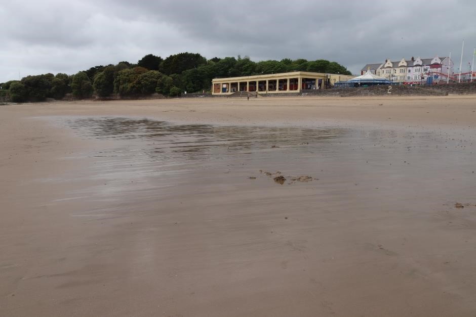
Whitmore Bay looking towards the promenade
Friar’s Point geological wonders
Given that most of my previous visits to Barry Island have been instructing scores of Marine and Environmental Geography university students over many decades and in many weathers into the coastal management of this coast, it was almost inevitable that we had to take a slight detour onto the rocky shore of Friar’s Point to point out the Barry Island unconformity and then go on to study the crinoidal limestones on the Point itself.
Although much of the Barry Island unconformity was largely obscured by brown seaweed, the contrasting angles of the rock layers at the top and bottom of the low-lying cliff were visible even to a non-specialist. As I explained to Heather, the underlying rocks (which are pointing towards the left in the photo) are ancient Carboniferous limestones which were laid down about 335 million years ago in warm tropical shallow seas, a bit like those off the east coast of Australia today (imagine Barry Island on the Great Barrier Reef!) The series of rocks lying on top however were deposited much, much later (around 200 million years ago in the Triassic) on land, many as screes and river sediments emanating from sudden flash floods which sporadically engulfed the desert-like environment of the shores of the large salty lake around which dinosaurs roamed. Geologists love this site because the unconformity, which represents a significant gap in time, is a bit of an enigma and is particularly well displayed at this site. What happened during the missing millions of years? Geologists have looked at all sorts of clues in the rocks here to try to understand this. If you’re interested check out this website to find out what they think happened. I’m particularly also intrigued by such unconformities as they were the inspiration for James Hutton, the Father of Modern Geology, in establishing key principles of geological science.
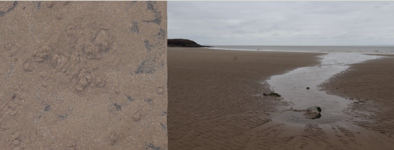
On the very tip at Friar’s Point, it was easier to demonstrate the geological interest, as the white minerals of fossils were now gleaming in the early afternoon sunshine. As the photo shows, the Carboniferous limestones teem with fossils, evidence of ancient marine life. Most obvious fossils are crinoids, marine animals which, with appendages which open up like a flower on a stalk, confusingly resemble plants more than animals, hence their common name, sea lily. These ancient, distant relatives of sea urchins and starfish, proliferated in the shallow waters of the time, not unsimilar to those where their living ancestors reside today in seas of the Gulf of Mexico and off Indonesia. Despite some rummaging around, our best finds of the day were broken fragments of the fossils, looking more like sticks of rock and polo mints than beautiful sea lilies.

Fossil crinoids (left) and the angular unconformity (right)
Shore treats – Old Harbour to Watch House Bay
If you want to avoid the longer route hugging the main road to Cold Knap, crossing the wide expanse of sand at low water between Friar’s Point and The Knap is preferable, although you do have to negotiate a small stream which meanders haphazardly across the beach and creates quite a challenge for those ill-prepared for such an obstacle. Not only is the route much quicker, but it also incorporates many features of interest – even more than we’d anticipated, as you’re about to find out.
Given Heather’s interest in tides of the Severn, we made a slight detour on the beach to study the muddier backshore behind the Old Harbour. Notwithstanding the decayed remains of a stranded and abandoned boat and an obligatory beach traffic cone, the backshore is remarkably natural, given its location. A saltmarsh sequence has developed here which sports a variety of hardy, adaptable plants which can tolerate the harsh conditions of the intertidal zone. At the edge of the mud, we carefully stooped down to study some salicornia (samphire) but resisted gathering it to garnish future fish suppers!
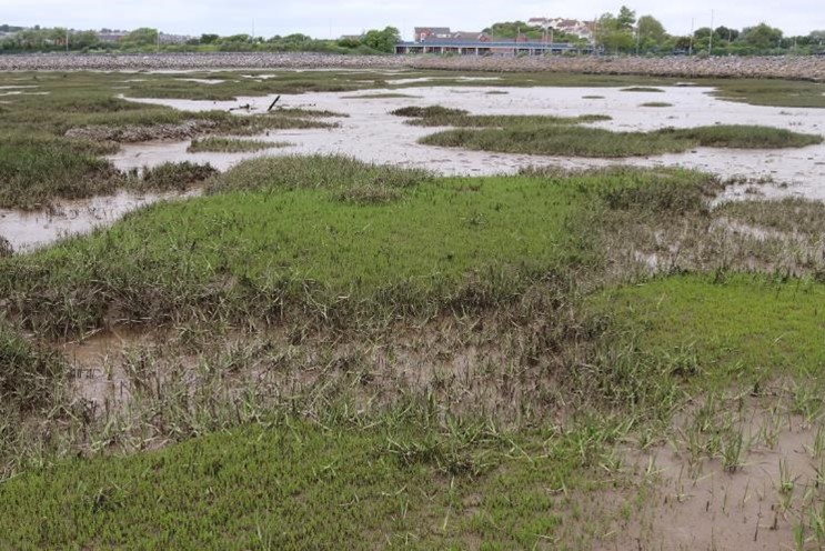
Salicornia and the marshy backshore with the current causeway
How this shoreline must have changed since 1896 when a causeway was constructed to provide easier access to the ‘Island’ for visitors who previously had had to negotiate the tides, like us, or take the more fashionable paddle-steamer provided by the Yellow Funnel Line. With its current road and rail links, the causeway now dominates the view and provides a hard, static structure against which rough seas must occasionally pound. Considerable siltation must have occurred following the causeway’s construction despite the shoreline looking so long established today. There were, however, constant reminders of the ephemeral nature of this shore as we moved towards The Knap. Fresh footprints from dogs, humans and birds criss-crossing over the sands would be washed away by the incoming tide within hours. The bubbling natural spring in the sands adjacent to Watch House Bay would also be engulfed by the incoming salty waters. Finding this spring was the highlight of my visit, having never seen or heard anything like this before. Photographing and videoing it from all angles and to the accompaniment of a constant burbling sound resembling an overactive coffee-percolator, I was fascinated by the endless bubbling up of the freshwater into the beach pools – Barry’s pseudo-volcanic world!
Freshwater spring on beach close to the Old Harbour
The Knap – the lake, lido and limestone pebbles
Ascending the slipway onto the Knap one is immediately aware that the coast here has a much more genteel and relaxed feel about it. Immediately behind the seafront immaculate public gardens surround a large artificial lake, the inspiration for Gillian Clarke’s poem ‘Cold Knap Lake’. This poem, which captures Clarke’s haunting childhood memories of the lake, alludes to a very different, more chilling experience than ours. Even the sizeable population of ducks and swans seemed to be enjoying the peace and calm of the Knap that day, silently huddling in groups around on the water’s edge. Previously one of the largest cold-water lidos in the UK, there have been campaigns to rebuild the attraction, but, despite considerable celebrity and community support, these have not been successful in contrast to similar efforts at Clevedon on the other side of the Estuary. However, I was to find out later that there are indeed new plans afoot for this area: an exciting local community scheme has been proposed to breathe new life into the iconic but somewhat dilapidated Old Lifeguards Building to create The Reef Coastal Exploration Centre (see inset below).
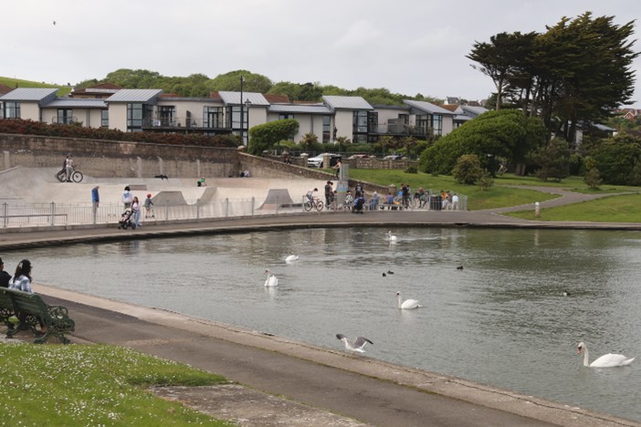
Knap Lake at Cold Knap
Y RÎFF/THE REEF: COASTAL EXPLORATION CENTRE, COLD KNAP – This community scheme hopes to transform this old building which was originally the cloakroom for the Knap Pool Lido in the 1920s before it became the home of the Rhondda (Cold Knap) Lifeguard Club. Plans include: A new up-to-date space for the Rhondda Lifeguards Club, offices for the Wales Coastal Monitoring Centre and an educational and community space. Find out more at: https://yriff.org/
Whilst the lake is a key attraction at Cold Knap for visitors and the many of the locals residing in the smart residential areas behind the seafront, it was the long pebble beach of gleaming white round limestone pebbles that appealed most to us. This stunning, long, steeply-shelving beach stretches in a great arc from the Knap around the bay towards and beyond Porthkerry to the west. This impressive natural feature is a reminder of the power of the sea and winter storms on beaches which are exposed to incoming southwesterlies. We contemplated the incredible strength of the winter storms which had created the beach and each of the ridges on the beaches seaward side. We feared what future climate change might mean for this beach system, given the road and cliff will not allow the beach system to roll back. Indeed, all the beaches we’d visited on our walk suffer from this same issue, making the problem of coastal squeeze a real likelihood. No wonder that the community is being encouraged to get involved in the monitoring of the nearby beach at Whitmore Bay through the CoastSnap Project.
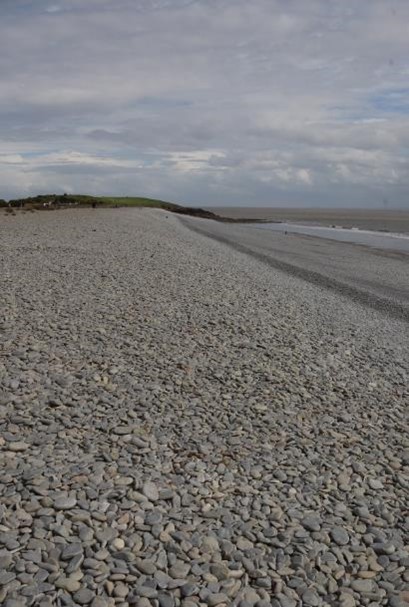
Storm beach at the Knap
The CoastSnap Project – ‘CoastSNAP, developed by the University of New South Wales, has become a beacon of community engagement and environmental stewardship. Over the past year, 3000 public-contributed photos have flooded in, capturing the ebb and flow of our dynamic coastlines. These snapshots serve as vital puzzle pieces, validating coastal surveys and informing our understanding of change in the face of rising sea levels. From storm events to the condition of coastal defence assets, CoastSNAP empowers us to protect our shores collectively.’ (Gwyn Nelson, WCMC). Find out more: General CoastSnap website: https://www.coastsnap.com/, CoastSnap in Wales: https://www.wcmc.wales/coastsnap

CoastSnap site at Barry Island
Walking across the pebbles of the more-or-less flat upper beach, our attention soon was diverted to watching the wind surfers who had presumably also conquered the demands of the descent of such a very steep beach on the seaward side! Knowing that there is a National Coastwatch Institution station at nearby Nell’s Point (see below), we could relax watching thrilling acrobatics of fearless wind surfers who seemed to be enjoying the challenges associated with the increasingly choppy seas. We also admired the pretty flowers of the many plants along the backshore which provided welcome bright dashes of colour against the grey-white pebbly beach. These include the occasional mauve native marsh-mallow alongside much more dominant plum and white valerians, presumably escapees from nearby gardens.
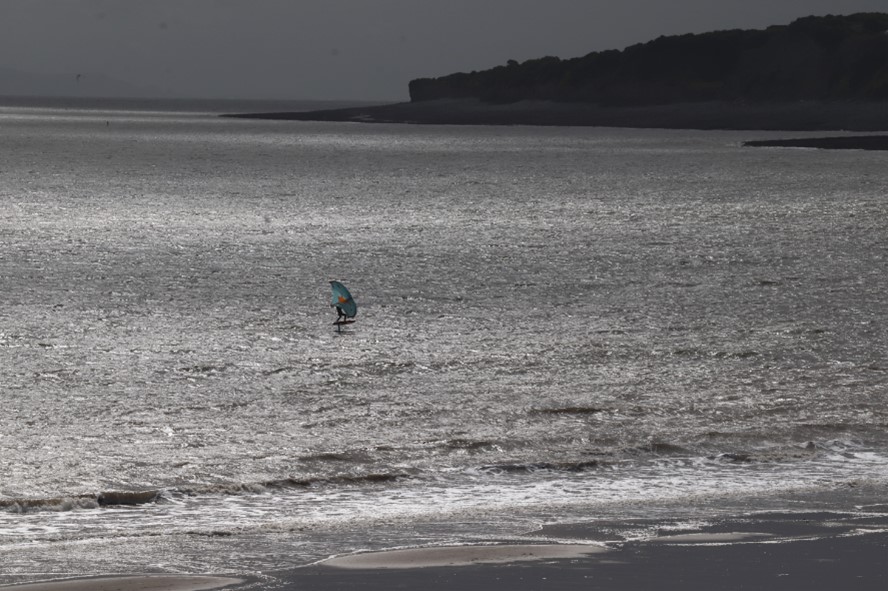
Wind surfer’s acrobatics on the beach at Cold Knap
National Coastwatch Institution (Nells Point) – ‘NCI Nell’s Point opened in 2017. Volunteers keep a daylight watch over the coast for anyone/vessel in difficulty and raise the alarm to Milford Haven Coastguard. Watchkeepers also respond to requests for information from the Coastguard on possible casualties etc. Sully Island causeway is a good example of how folks get into difficulty as it covers over at about half tide and folks unaware will be cut off. So, the watchkeepers at Nell’s Point will inform the coastguards who will arrange a rescue. Over the last 5 years or so there has been a significant increase in both water users and the type of personal watercraft used. Open water swimming, in particular, has increased greatly around Barry with new clubs and societies being formed.’ (Nick Rodgers, Barry). Find out more: National Coastwatch Institution
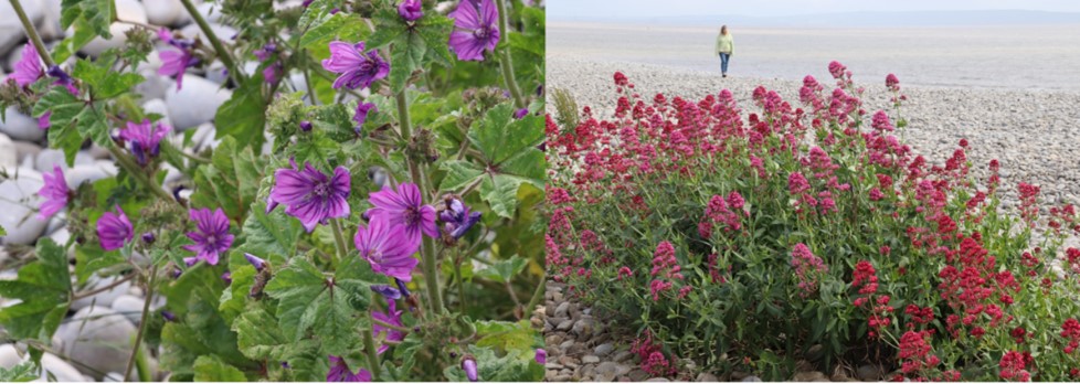
Flowers on the backshore at Cold Knap
No introductory visit to Cold Knap would be complete without viewing the site of the old roman villa, a late third century ‘mansio,’ thought to have been a guest house for travellers. Set neatly and strangely in line with the modern neighbouring apartment properties, the floor plan of villa was very clear to us – with over twenty rooms arranged around a courtyard, this was no ordinary B&B! Given its proximity to the coast at the time (the gardens on the Knap are thought to have been an inlet of the sea), it’s likely that many of its visitors would have come by sea rather than by land although the A48 lies along the route of an acknowledged roman road. Archaeologists suggest that the Romans would have needed many stopping points along the Bristol Channel given the capability of their boats at the time.
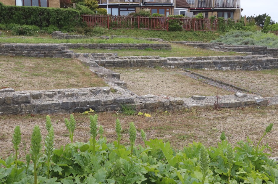
Roman villa at Cold Knap
Over the hills and not so far away, to Porthkerry
After our gentle stroll around Cold Knap we were in for some more strenuous exercise. The antics of a group of energetic sea gulls which were riding the thermals were, however, a most welcome distraction as we ascended the steps and steep grassy slope above the Knap. As we continued along the coastal path towards Porthkerry, I was reminded of my first outing here after the initial travel constraints of COVID. The view from the top of the hill of the wide expanse of the Bristol Channel offshore at the time had been quite stunning, almost shocking. Today, it was just a little dull given the greyness of the cloud cover and sea. However, we were shortly into the beautiful deciduous woodland which hugs the coast and were soon admiring some of the majestic and mature trees which are so prized here.
All too soon, we were descending an even steeper slope and longer set of steps down to Porthkerry Country Park. With no time to look for the pirate treasure which legend suggests lies hidden beneath the Golden Stairs, and tired from our earlier exertions, we only made a brief visit to the pebbly shoreline. Looking back along the storm beach to the Knap, we admired the impressive cliffs which surround the bay, reminiscent of those further west along the Glamorgan Heritage Coast. However, even I did not have the energy to explain the geology at this point, so we made our way to the café for a very late lunch. Crossing quickly over neatly laid out boardwalks and glancing at the many interesting information panels along our route, we soon realised that we’d really need to have another visit to really appreciate the attractions here. So, we just sat outside and ate our well-earned lunch and enjoyed the view of the impressive Victorian viaduct which dominates the valley here, trying not to contemplate our return up those not so Golden Stairs.

View towards Cold Knap and Barry from Wales Coastal Path
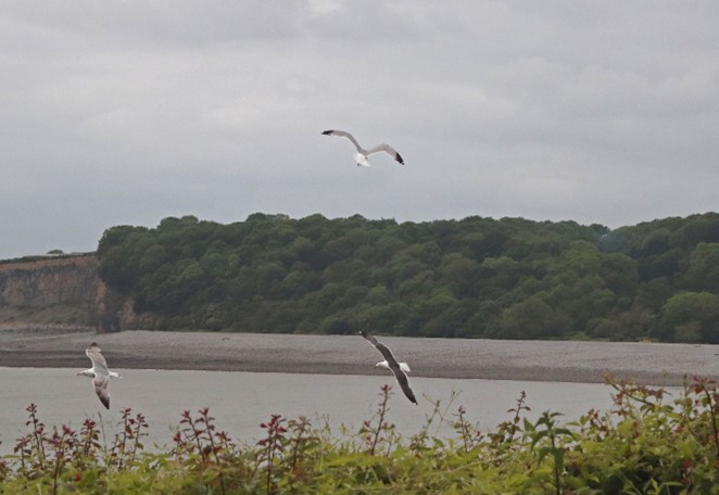
Seagulls enjoying the thermals!
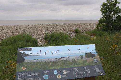
Porthkerry beach with information panel
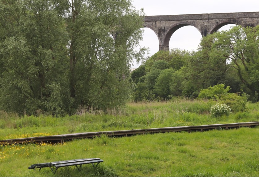
The Victorian Viaduct at Porthkerry
Final thoughts
Another fascinating coast where there is such diversity of shoreline within a relatively short distance. Even on a relatively dull day, the seaviews of the islands and Somerset coast on the other side of the Channel are most impressive and so, why not sample these Barry delights along the Wales Coastal Path? If my writing hasn’t tempted you so far, then I’m sure the perspectives of three very proud Barry locals, provided below, will inspire!
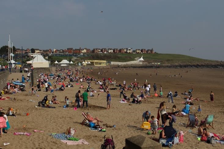
Whitmore Bay on a previous sunny day!
Nick, local resident and active member of the local National Coastwatch Station
My connection with the Estuary/Barry: I’ve been a resident for the last 25 years, having returned to my hometown. I learned to swim and sail in the waters around Barry. Our family are regular beach users, and I am a watchkeeper with NCI Nell’s Point on Barry Island.
What I like most about the Estuary/Barry coast: I really enjoy the different moods of the weather and water combined
Future challenges – dealing with the increase in water usage and keeping folks safe, ensuring the water quality is good, dealing with new erosion points as sea levels rise
How I imagine the Estuary/Barry coast in 2050: Sea levels will have increased by 2050 which will make the high water mark very interesting! Also, I suspect the use of the water will continue to increase with possibly larger vessels and a number of as yet uninvented methods of taking to the water!

Gwyn, local resident and Manager of the Wales Coastal Monitoring Centre
My connection with the Estuary/Barry: My great-grandad was a commercial diver in Barry docks with an old school copper diving helmet/air hose! Every generation in my family has worked in the marine sector since. I’ve maintained a marine career as a skipper/hydrographer and now coastal surveyor, I’m forever drawn to these shores and I appreciate them more as I get older. I’m a voluntary lifeguard coach and I am now able to share my childhood coastal experiences with my own children.
What I like most about the Estuary/Barry coast: The quiet spots. Going for runs across the deserted limestone intertidal at Porthkerry or paddle boarding the sheltered waters at the Old Harbour, just being next to the coast has become important to me.
Future challenges: Most topical is water quality from CSO’s and then managing an increase of users but there are plenty of successful models to learn from. Long-term climate change impacts with sea level rise and increased flooding/erosion is also a significant challenge.
How I imagine the Estuary/Barry coast in 2050: More populated but well managed. In recent history, Barry has been underutilised, until COVID when locals and new residents flocked to the coast to make the most of its wellbeing benefits. COVID has unlocked Barry’s natural potential with increased walkers and sea users, I think Barry will increase in popularity and Whitmore be more like a ‘city’ beach but I think increased traffic will be managed sustainably and add value to locals and tourists.
Janet, local resident and former Severn Estuary Partnership Manager
My connection with Barry: I was born and bred in Barry. My maternal grandparents moved here, when Barry was thriving as a seaport and an ever-expanding town. They had a stall on Barry Island fairground selling ice cream and candy floss to coal miners who came to Barry Island each year for their one annual trip to the seaside. In winter months my grandfather sold coal to homes in the west end of Barry from his horse and cart.
As a young adult my all-consuming interest was sailing, and I became the first woman in Barry Yacht Club to become a qualified Offshore Yachtmaster. I became an Auxiliary Coast Guard working day and night shifts at the Nells Point Lookout Station, accessed through Butlins Holiday Camp at that time. I wrote a monthly column bringing news of the Bristol Channel to Yachting Monthly magazine readers for many years. Later, I became a yacht broker based at Barry Harbour, and then the admin officer for the Flat Holm Project, which included crewing on the Flat Holm Island boat and giving guided tours to island visitors.
After becoming intensely interested in the natural environment of our seas and coasts, I eventually became the Project Manager for the Severn Estuary Project, tasked with developing the first-ever management strategy for the Severn Estuary. I revisited many of my sailing haunts on the Estuary, but this time facilitating stakeholder workshops for a diverse range of professionals and recreational users.
What I like most about the Barry coast – Barry town (including Barry Island) is blessed with five different beaches: Porthkerry Beach and the Knap beach forming a pebble bay, plus the sandy beaches of Watchtower Bay, Whitmore Bay and Jackson’s Bay. I like the dynamic environment caused by our second highest tidal rise and fall in the world. I’ve visited the Bay of Fundy in Canada, the only place in the world with a greater tidal range than the Severn Estuary. The Bay of Fundy is marketed to tourists as a place where you can “walk on the ocean floor” when the tide is low. However, for me the beauty of the cliffs of the Vale of Glamorgan Heritage Coast is even more dramatic, as are the low-lying wetlands and wildlife sanctuaries further up-channel, where rivers from valleys and fields flow into the Estuary
Future challenges – achieving and maintaining good water quality. This concern includes the water quality on all the rivers flowing into the estuary. Of course, flooding and coastal defence issues are with us too as storms seem to be increasing and global warming continues.
My vision of the coast in 20/50 years time – I hope that the Estuary and all that it offers will be cherished and its natural areas carefully managed for future generations to enjoy. I hope that people will understand and value this dynamic environment, where the waters will never be a clear blue, because the seabed and its sediments are constantly churned and held in suspension by the immensely powerful tides and currents.
Further information
If you want to find out more about this walk and its interesting features check out the following websites:
Online walks:
Weatherman walking – Barry to Rhoose Point
Audio stories to accompany your walk
Historical aspects:
Geological aspects:
Discovering geology – crinoids