Gloucester and the Severn – maritime connections and more
Gloucester and the Severn – maritime connections and more
Written by Dr Rhoda Ballinger, SEP Chair
This month, Rhoda explores the northern end of the Gloucester and Sharpness Canal, delving into the rich maritime and medieval heritage of the City of Gloucester and discovers some interesting connections with the Severn.
As promised, this month’s estuary exploration took place alongside this year’s Severn Estuary Forum, enabling me to discover interesting connections between Gloucester and the wider Severn Estuary, as well as delve into the history and current uses of the Gloucester and Sharpness Canal. Given a somewhat flaky weather forecast, I decided to split the walk over two half days either side of the forum so that I just might enjoy a little sunshine. However, as you’ll see later, this resulted in some rather variable weather conditions and an even more mixed bag of photos! Having hugely benefitted from Barney’s input last month, which had kindled my newfound interest in the maritime connections and past of this part of the Severn, I contacted Chris Witts for his impressions and insights. As a prominent Severn author and speaker, Chris had worked as a Skipper and Mate on a couple of barges carrying grain from Sharpness to Tewkesbury before taking on the role of Mayor and Sheriff of Gloucester.
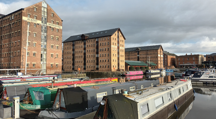
The impressive Victoria Dock with its imposing warehouses and colourful long boats
An unexpected glimpse into medieval Gloucester
In the afternoon sunlight, an intriguing and quite imposing historical building set amidst vibrant green grounds immediately caught my eye as I peered out from my hotel window in the new development adjoining Gloucester Quays. Lured to the other side of the canal, I found the tranquillity of this unexpected haven enchanting, as it nestled between the very bold, very blue and recently built Gloucester College and a number of tidy modern apartment blocks. As I was enjoying the scents of rosemary, thyme and other herbs wafting from the herb garden immediately in front of the historic buildings, my near-constant camera activity had caught the attention of the Visitor Experience Officer, Ray. Before I knew it, I was being given a personal one-to-one tour of the remains of Llanthony Secunda Priory.
A welcome green space in today’s docklands area and a surprising find, the attractive grounds and recently restored buildings of Llanthony Secunda Priory
Established nearly nine hundred years ago, in 1136, just outside the then city walls of Gloucester, the priory was built to house retreating Augustinian canons who had been given a hard time from the locals around their ‘parent’ Llanthony Priory in the Vale of Ewyas (now within the Brecon Beacons National Park). They liked it in Gloucester and stayed. Indeed, the priory became not only a significant religious centre but, also, like most other medieval religious sites in and around Gloucester, it grew into an important education establishment. As well as running schools in the local area, the priory’s canons also provided hospitality to locals and visitors. However, it was for its cheese-making that were best known in the early sixteenth century. Not Double Gloucester cheese (sorry I haven’t researched that), but ‘Lanthony’ cheese. This, alongside the first lamprey of the fishing season, was sent to the sovereign at Windsor every year. Today, the view to the river is blocked by various industrial premises and other buildings, so, unfortunately, the only reminders of the Severn’s proximity are exhibits in the Information Room: a reproduction of John Speed’s 1616 ‘map of Glocester’ and a copy of Thomas Harral’s 1824 illustration which shows sailing ships in front of the priory’s remains. Clearly the river was a vital resource here for many centuries. Indeed, Speed had highlighted in his supplementary text the ‘special glory’ which the Severn bestowed on the good gifts of the land.
Thanks to a major recent restoration project, you now can begin to appreciate the significance of this site and you can admire some of the recently restored medieval structures, especially on a lovely sunny afternoon. However, given the site’s complex history since the priory’s dissolution in 1539, the remains you see today are only a small portion of the original buildings, and, as the caption below indicates, even the original function of some of the buildings is a bit of an enigma. According to Ray, there’s also the faint possibility that the nursery rhyme ‘Humpty Dumpty’ may have its origin from a supposed incident on the priory walls during the Siege of Gloucester during the English Civil War in 1643! Hmmm… I’m not that convinced, even though Ray was quite persuasive – it seems like Colchester also lays claim to this momentous event!
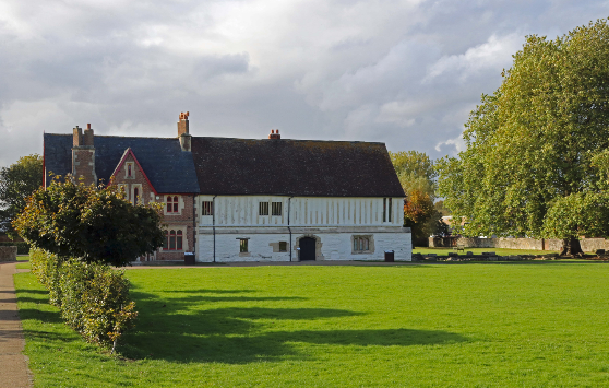
The half-timbered range of Llanthony Secunda Priory – this building poses more questions than answers in terms of its original use– was it a storage facility or even a stable?

The Docks – Some very special maritime heritage
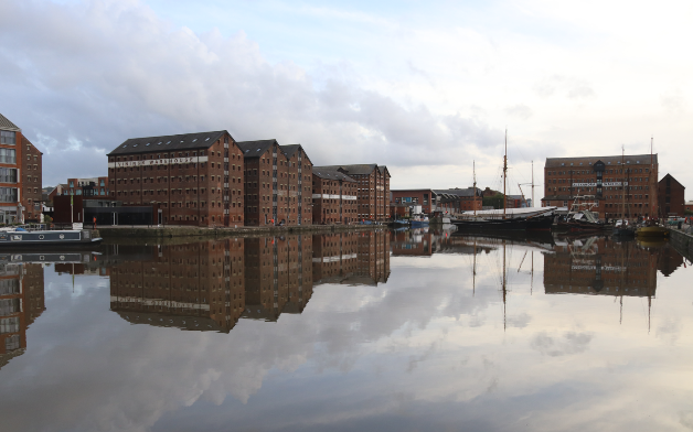
Reflections of the impressive Victorian (1830s-40s) warehouses of Main Basin
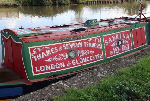
One of the many colourful narrow boats along the canal close to the Docks
Although I’d love to have had time to visit all twenty or so other sites which form part of the Gloucester Medieval Trail, I needed to explore the Docks and their connection with the Gloucester and Sharpness Canal, as I’d intended. Well, if Purton had seemed like a neat model village on my last walk, Gloucester Docks could have been a backscene for a model railway, or even a film set for a Victorian thriller. They were certainly impressive. Imposing, tall and slender brick-built warehouses rose proudly from the quaysides and their long reflections shimmered in the grey still waters of the canal and docks – quite a photographer’s dream even on a greying afternoon. No wonder these are considered the best-preserved example of Victorian Docks in the country and recently have been awarded the highly prestigious Heritage Harbour status earlier this year. Studying the names of the narrowboats kept me amused for quite a while –Nut Cracker, Amber, Evolution, Wildlife, Little John and Sabrina, to name just a few. However, it was the combination of slightly quirky public art sculptures and actual historical artefacts dotted around the docks which made me curious to find out more about the history of this the most inland of ports in Britain, where inland waterways and seagoing vessels have come together to define the maritime edge of the estuary.
As I was to discover from display panels around the Docks and a fascinating visit to the National Waterways Museum, there are nearly two hundred years of maritime history here. There are innumerable superlatives too – back in 1847 the largest wet dock in the world was constructed here; at their peak, the Docks employed over 3000 people. Certainly, the completion of the Sharpness Canal in 1827 was a turning point, enabling Gloucester to compete with Bristol as a port, given that the treacherous waters of the Severn could now be avoided between Sharpness and Gloucester. Gloucester Port had other advantages compared with its southern rival: its proximity to the Midlands, its superb rail links and lower costs. No wonder that it became a major hub of activity in the 19th and early 20th Centuries, boasting significant trades in grain, timber, wines and more, including petroleum products in its later years.
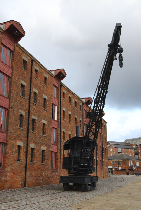
A striking crane on its old tracks in front of North Warehouse. This was the first warehouse to be built in 1826/7 and had stored corn, wines and spirits
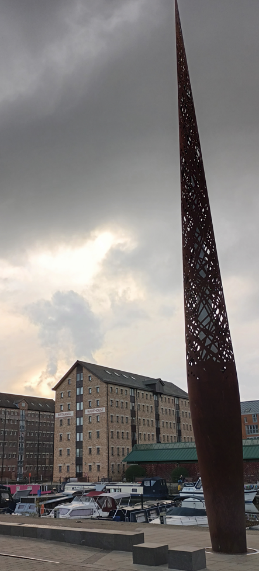
The Candle, or the Rusty Needle as some locals refer to it, rises 21m above the quayside and has lines from the poem, Requiem, by Gloucester Ivor Gurney, engraved around its base (and, as you can see, was quite tricky to photograph!)
Sadly, however, not a single example now exists here of the Severn Trow that once carried so much of this trade, although the museum does offer a reconstruction made out of rope (see photo below): you have to travel up river to the Ironbridge to see the last surviving trow, Spry. These unique sailing craft evolved over eight hundred years to cope with the physical demands of the river and estuary as well as with ever-increasing cargoes and efficiency demands: their sturdy construction and flat-bottomed hulls were particularly suited to the shallow waters of the Severn.
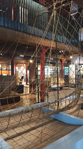
A replica Severn Trow constructed out of rope in the National Waterways Museum
What the museum perhaps lacks in genuine historic vessels, however, was made up for by an interesting selection of smaller artefacts and most particularly by a display featuring a series of short video clips from old sailors who’d lived and breathed the waterways. Drawn in by their rich Gloucester accents and their passionate delivery, I sat alongside a huddle of other visitors to listen to their fascinating stories. Chris Witts painted a vibrant picture of his life on the river and canal. However, for me, Roy Beckett’s recollections were particularly poignant. He vividly describes his working life on the waterways, which began when he was only fourteen years old. He makes no bones that it was a hard life – ‘you never stopped, never… working in all weathers,’ being paid ‘by the trip and tonnage.’ However to Roy, the Docks in their heyday had been ‘really something special,’ and ‘in every way… magic,’ including the ‘sound of the mills’ in the evenings, ‘the gas lighting’ and even ‘the smell around the dock.’
I came back out onto the dockside by the museum reflecting on Roy’s comments. Had the ‘magic’ really gone? Those very ‘magical’ docks had fallen into disrepair in the 70s before finally closing the following decade, as ship size and competition from road transport increased, and petroleum works were relocated further south on the estuary. Whilst many may just get a romantic interpretation of Gloucester’s maritime past from the nearly scrubbed up quaysides today, I was delighted to discover that there is still an active maritime industry here. The rich maritime history lives on with a number of specialist companies undertaking ship restoration and historical ship building. T. Nielsen and Company with its extensive facilities and dry docks, has not only achieved worldwide recognition for its work with historic timber ships but has also earned a reputation for its provision of specialist skills for film and TV studios requiring specialist marine structures, boats and rigging. The hulls of some of the historic vessels undergoing maintenance and restoration certainly made for quite a picturesque photo. However, the masts of the most notable vessel in the basin, Kathleen and May, the last remaining three-masted topsail trading schooner, were clearly under wraps, as the vessel undergoes routine maintenance. What a sight it must have been during the Tall Ships Festival earlier this year, when this and other schooners were afloat in the Docks! I’m excited to learn that the next one, in 2027, will be an even more impressive celebration, to mark the bicentenary of the opening of the Gloucester -Sharpness Canal and the docks.
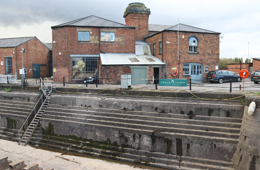
A dry dock facility dating back to 1853 is still used for boat restoration by the T. Nielson Company
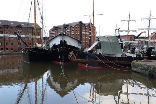
Historic vessels, including the hull of Kathleen and May, moored in the Main Basin
Gloucester Dock and some unexpected links to the Severn
Without the large ‘Strong Stream Information’ display board positioned at the end of the Main Basin I could easily have missed Gloucester Lock, the access for ships heading to and from Tewskesbury over the centuries. Water from the Severn, coming in through this tiny, narrow lock provides a key source of water for the canal, keeping the boats in the docks and canal afloat. More surprisingly, the canal provides millions of litres of water for Bristol,supplying nearly half of the city’s water needs. Chris Witts, however, is concerned that the East Parting section of the river may silt up in future, referring to a study on the river some twenty or so years ago. If this is true, I assume this might threaten these water transfers. Chris is also worried about change in dredging equipment and techniques since a ban on bucket dredgers by the EC some twenty or so years ago. I haven’t had time to look into this further, but I do know there’s been considerable unease in the local press about the provision of water to Bristol and its potential link to dredging activity. One local press article has even suggested that the trust is ‘doomed to pump silt in forever’ to supply Bristol with water. Certainly last year, following the exceptionally dry summer of 2022, more water from the river was required to supply Bristol as water resources dried up in the drought. According to Dredging Today, some 20,000 cubic meters of silt were removed from the docks following a silt built up, resulting in the Canal and River Trust setting aside about a quarter of its national dredging budget to do work here (Gloucester news). I’m not an expert on canal dredging and siltation, despite my background in Physical Geography, but I do hope the possible increased likelihood of summer droughts has been taken into account for the future maintenance of the canal, given the vital role it plays for the city and the whole Severn shoreline down to Sharpness.
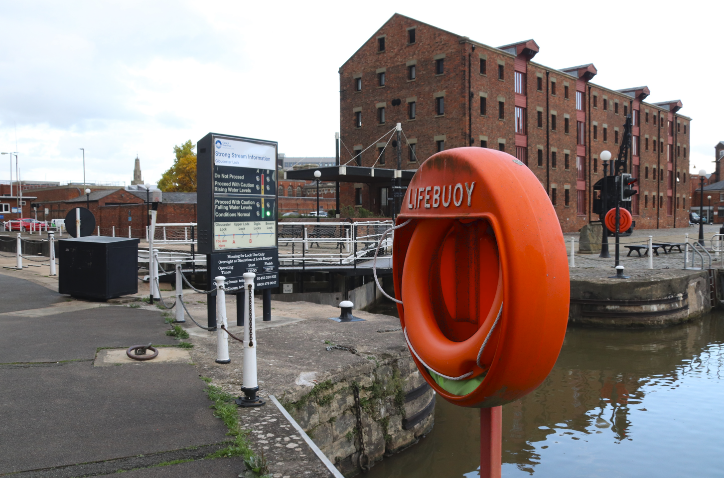
The dock entrance to Gloucester Lock, the only access for boats and barges to the River Severn (East Channel)
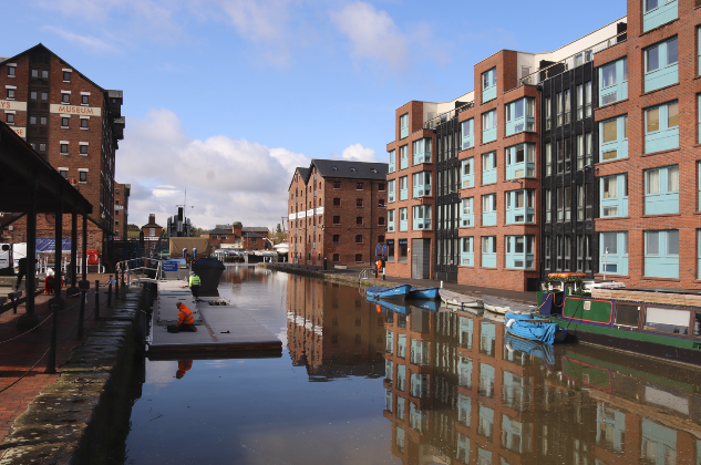
A blend of old and new off the Main Basin in Gloucester’s Historic Dock area
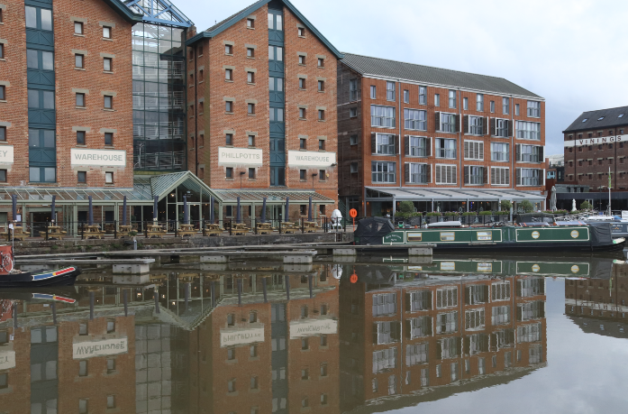
New apartment blocks complement converted warehouses with around the Main Basin
The Docks – a redevelopment triumph?
As I walked back to the hotel I was surprised to see that the areas of dereliction and scruffiness, which I vaguely remember from a previous visit years ago, had all but disappeared. An immense redevelopment programme has clearly taken place here to restore and showcase this special architectural and historic site. I was struck by the cohesiveness of the redevelopment, particularly compared with some other maritime redevelopments in the UK where you have to look hard to discover any maritime past between featureless modern retail units and apartment blocks. Here old and new effectively complement each other (although I do have my own views about retail outlets and chains which might jar here). It is a thriving area– even on an October afternoon, there was a constant hustle and bustle as people went about their sightseeing, shopping and other recreational activities. Certainly, on the surface it seems like the multi-million restoration project, which was one of Gloucester’s ‘Magnificent Seven’ regeneration sites following an unsuccessful bid to host the 1992 Olympic Games, has been more than worthwhile. As I understand it (from reading more widely around the history of Gloucester’s redevelopment) there have also been many lessons learnt from the process of regeneration here, particularly ones associated with the complex interplay between the various interests at play, aptly described by Atkinson and others as a metaphorical ‘bowl of spaghetti’.
I was very aware of the continuing restoration around the Docks as I detoured around cordoned streets and alleyways to find my way back to the hotel at the end of my first half day’s exploration. Bakers’ Quay and environs are the last piece in the redevelopment jigsaw, having lain vacant for over a decade. Apart from the much-needed restoration of a malthouse and warehouse, the construction of a 10 storey tower as part of this final redevelopment scheme, has been, and is probably still, controversial. Described as both a landmark and an eyesore by the local new media, it was no surprise to learn from a BBC Gloucester News story that permission from the planning committee for the developers to go ahead had only been granted by the smallest of margins. I certainly hope it will complement the existing Dock area.
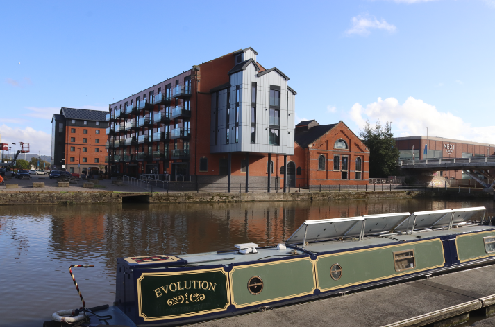
Some of the most recent developments in the final phase of Dock regeneration
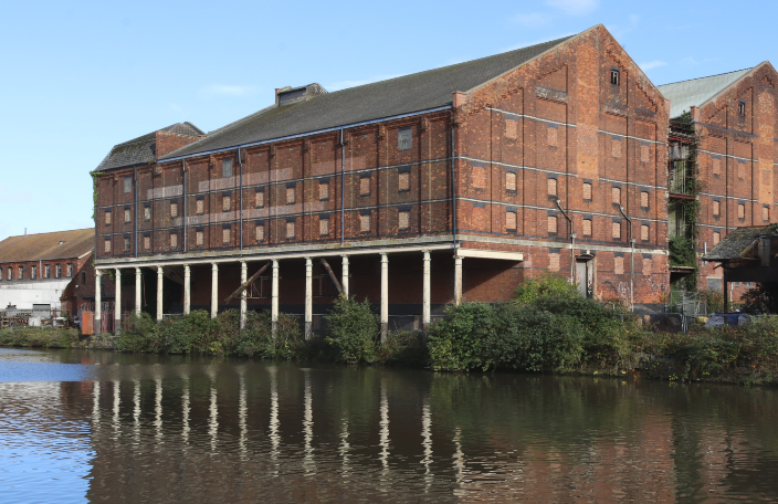
Part of the Bakers’ Quay redevelopment site – the c1838 Pillar Warehouse projected over the dock to enable cargoes to be directly hoisted off ships
The Canal – a peaceful haven?
I’d been particularly looking forward to exploring the northern end of the canal after last month’s walk. However, with large dark grey rain clouds gathering, it felt more like a duty than a pleasure to walk along the tow path at the start of my second half day’s exploration. Early impressions did little to spark my enthusiasm – there was graffiti under the swing bridge, litter in the canal and featureless modern industrial vistas on the opposite side of the bank, and I was nearly knocked over by one of the many cyclists who seemed to think the tow path was for their sole use. However, before too long I found myself trying to capture the reflections of some of the industrial buildings in the sluggish brown-grey canal waters. Within no time at all, my photographic activity attracted the attention of inquisitive walkers, joggers, fishermen and other path users, all of whom were very keen to share their stories and views about the canal and its upkeep. Clearly, this is a vital green space for locals who enjoy the relative peace of the tow path for their daily exercise and refreshment. A couple of fishermen, who’d clearly settled down for at least the morning, gleefully told me they were there to catch ‘anything that bites’ (largely bream); another elderly gentleman on a mobility scooter proudly showed me his lunch, ‘Blue-Leg Mushrooms’, which he’d just collected from ‘a secret place’ near the canal.
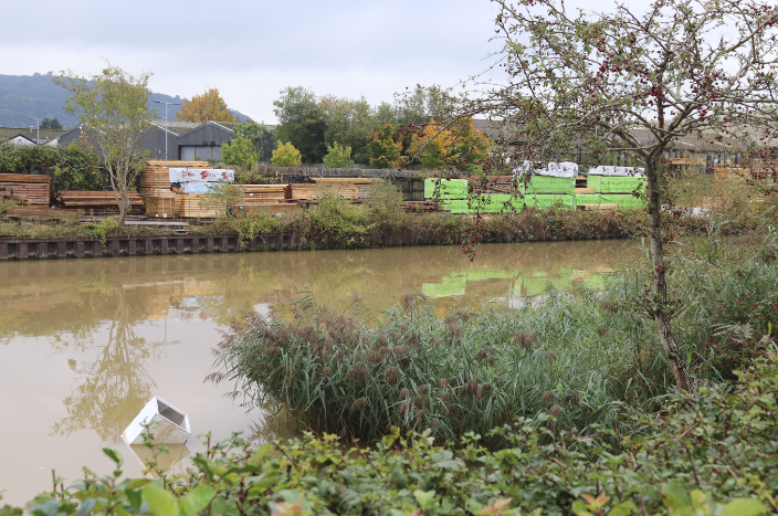
Industrial vistas and pollution along the northern section of the canal
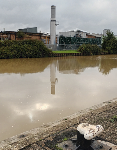
Scenic reflections of modern industry along the canal
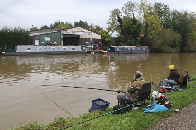
Sitting comfortably, waiting for ‘anything to bite’ (probably bream)
As the sky darkened further, the prospect across the canal of a warm Costa was most appealing but I continued on my mission to reach the river itself. As I quickened pace, I was overtaken by various canal users – narrowboats, kayakers and keen rowers from the Gloucester Rowing Club, some of whom were practising their timings alongside their buddy cyclists… hmmm, yes, on the tow path! As I walked south, the urban landscape gradually gave way to pleasant woodland areas and attractive banks replete with almost ornamental russet autumnal plants bearing a multitude of different seed heads. I learnt later this is part of the Gloucester Nature Park, a new project masterminded by the Gloucestershire Wildlife Trust and partners, which will transform some of the undeveloped land around the Severn to create new accessible habitats alongside other environmental benefits. Clearly, the local people I spoke to are very much in favour of such an endeavour. Just before I took the turning off along the road towards the river itself, memories of the Sharpness canal section came flooding back – swing bridges, gaily decorated longboats with their pretty flower pots and even a bridge-keeper’s house almost identical to the one I’d photographed at Purton.

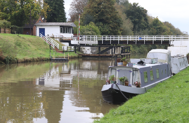
The Sims Swing Bridge and some more narrow boats

Teasels and other autumnal foliage form fascinating natural art creations along the canal bank
The Severn at Elmore
As the rains came and puddles expanded, it was somewhat of a relief that there was only a short section of minor road to walk along before I got to the Severn. Across the field where the Severn Way led down to the river I was warned by a local, who was nervously studying the river level, about the slipperiness of the path. Slowly and cautiously, I negotiated a few hundred metres of ‘path’/ waterlogged field, to arrive at my destination. Greeting me was a living water body, flowing gracefully downstream, meandering gently between high muddy banks and attractive agricultural land. There was even a waddling of mallard ducks on the opposite riverbank. Such a contrast to the canal, but just as attractive; no wonder the Severn had been described as the ‘queen’ of rivers by the artist Thomas Harrel in his historical and topographical masterpiece ‘Picturesque views of the Severn’. I’d certainly confirm that his two-hundred year-old description ‘the sweet interchange of hill and valley, wood and pasture, which are displayed upon her shores, excite the most delightful and sublime sensations’ might just be more relevant still on a sunny day, although I’d probably be less poetic in my interpretation of the scene on a grey rainy October morning. Certainly, I’d agree with Chris Witts, the Severn is so ‘unique, very parochial and interesting’ along its whole course from the source to the sea. Each section does indeed have its own character. I’m not quite sure that this stretch of river today matched Chris’ description as the ‘naughty adolescent, though I’m sure once the river is in flood I might change my mind. As the river seemed to pick up pace and I watched a small flotilla of debris float past, I decided to back track: I really didn’t want to experience the ‘naughty’ side of river – my feet were already wet enough.
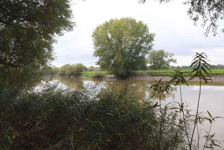
Chris Witts’ ‘adolescent’ Severn near Elmore
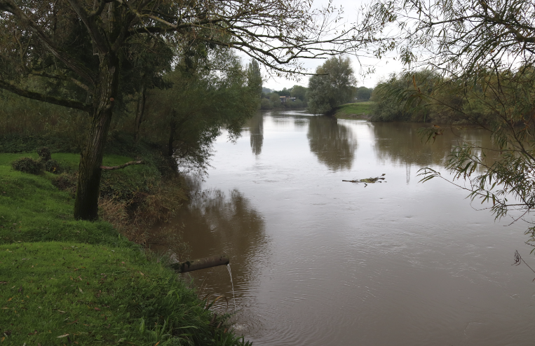
The first flotilla of debris following recent rains
Final thoughts
Completely soaked, I took refuge in the warmth of the Costa I’d spotted previously, before throwing in the towel and catching a local bus back to the city centre. I certainly didn’t want to become another Dr Foster (whoever they were!), as I would like to return and explore Gloucester and the river here further in the near future. Although I’ve discovered some really interesting and unexpected links between the places I’ve seen here and the rest of the estuary, I’ve not quite reached the tidal limit of the Severn yet. I’d like to look into some of Chris’s comments about this ‘naughty adolescent’ river and research some of his concerns about the East Parting. I think my exploration of the northern limit of the ‘estuary’ will have to wait until one of next year’s four star bore events though. In the meantime, I have another offshore and different perspective to share with you next month!
A few more interesting snippets of information
Who was Dr Foster – https://gloshistory.org.uk/sites/reprints/gh199402.pdf
Gloucester Docks and the Sharpness Canal Past and Present https://www.gloucesterdocks.me.uk/
Kathleen and May– https://www.nationalhistoricships.org.uk/register/146/kathleen-and-may
Severn Tales by Chris Witts https://www.severntales.co.uk/
Some more serious reading
Atkinson, R., Tallon, A. and Williams, D., 2019. Governing urban regeneration: Planning and regulatory tools in the UK. Eur. Plan. Stud, 27, pp.1083-1106
Conway-Jones, H., 2009. Gloucester Docks: An Historical Guide. Black Dwarf Publications.
Maliphant, A., 2014. Power to the people: Putting community into urban regeneration. Journal of Urban Regeneration & Renewal, 8(1), pp.86-100
 Severn Estuary Partnership