Visiting Flat Holm / Ynys Echni: a new estuary perspective
Visiting Flat Holm / Ynys Echni: a new estuary perspective
Written by Dr Rhoda Ballinger, SEP Chair
Join me on my day trip to Flat Holm/Ynys Echni where I discover how much of the island’s natural and cultural history echoes the good and bad times of the wider estuary. You can also read a few revelations about island visiting and living there too!
I’d been so looking forward to this special day for some time. The SEP Team had given me a Bay Island Voyages voucher for my retirement for my husband and me to use. Some months later, here we were waiting for our rigid inflatable at Mermaid Quay, Cardiff Bay. Amazingly, it was a calm sunny autumn day, and the still waters of the Bristol Channel were beckoning. We were off to Flat Holm / Ynys Echni!
This isn’t the first time I’ve ever set foot on the island, but I felt mounting excitement as our powerful dinghy came into view. That excitement about Flat Holm is shared by a few current and former SEP Management Group members, who’ve had first hand experience, working and living on the island. You’ll be hearing from them, Dave, Jan and Natalie, as we go on.
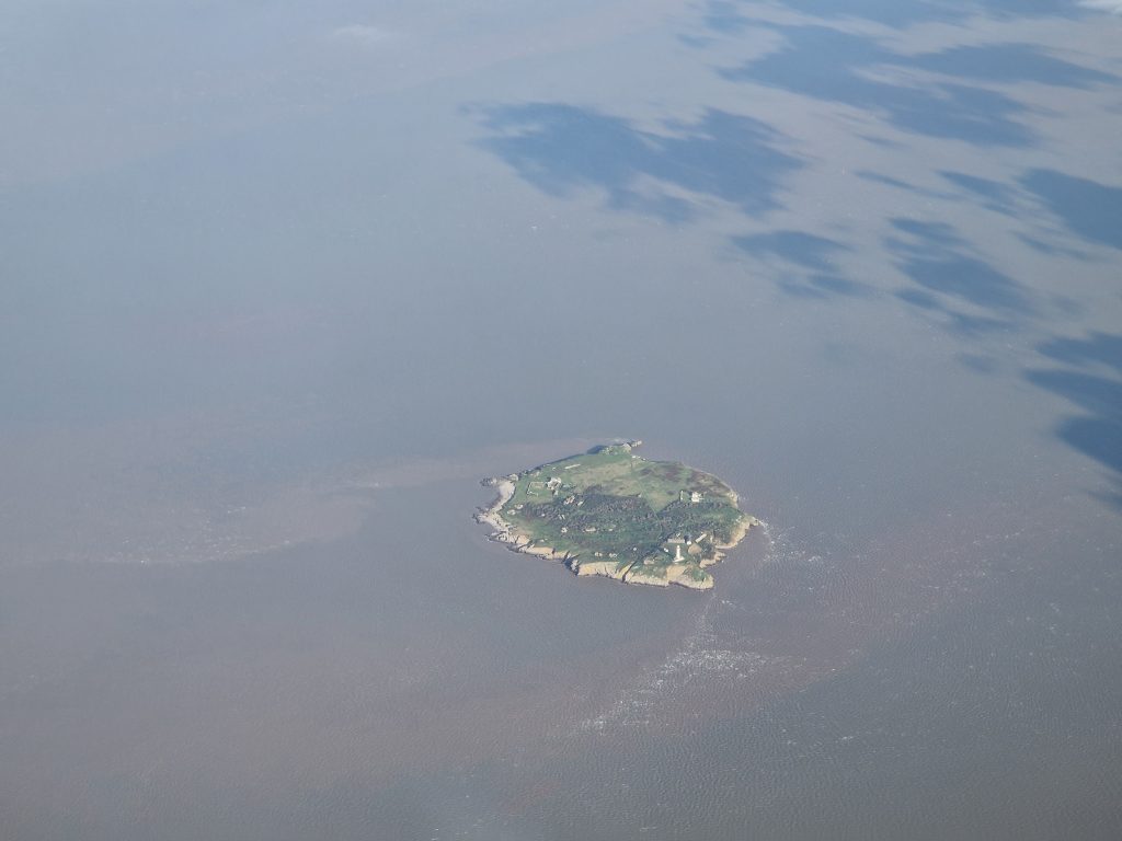
Flat Holm from above (photo: Sam Brown)
All aboard to Flat Holm / Ynys Echni
This was no nail-biting excursion around the Bay with screaming kids like I remember from my last excursion with Bay Island Voyages for our son’s birthday treat years ago. Today, after a short burst around Cardiff Bay to amuse the one and only child onboard, we took our place in one of the towering locks of the Barrage, alongside a variety of other vessels, including a stately yacht and a fishing boat, to wait for the water level to reach that of the estuary. Having navigated our way through the lock, our rigid inflatable, the Celtic Pioneer, took ‘flight,’ swiftly escorting us into the wide expanse of sparkling blue water of the Channel. There were spectacular views to the islands, which brought back memories of my recent sail on the Waverley and flashbacks to other more adventurous maritime adventures on the old Maritime Studies Department’s (Cardiff Uni) inflatable years ago. Within minutes, with 450 horses pulling us along/ oops, no – with the mighty thrust of the 450 HP of our outboard engines, we were soon dropping speed at the approach to Flat Holm, the most southerly location in Wales. We gently glided past striking grey-white limestone cliffs, admiring their contorted beds and curious shapes, which cast intriguingly long shadows across the bay in the bright autumn sunlight. These mighty natural structures not only frame the northern entrance to the island but also tower above the steep jetty. They certainly reminded us that this is a wild and potentially dangerous place with an immense tidal range.
Fortunately, there was no difficult landing today – just a small step onto the jetty and we were all ashore in minutes. This was nothing like some of the previous managers’ and wardens’ recollections: indeed, Dave Worral, former Flat Holm Ecologist and Project Manager, recounts the great team efforts required for deliveries, particularly in the early years of the Flat Holm Project as many of the buildings were being restored. He remembers the delivery of old telegraph poles which BT had donated to help with the construction of the barn. These had been ‘pushed into the estuary at Barry Dock, lashed together, towed out by the Lewis Alexander and then dragged ashore before being moved to the farm one at a time.’ Life on an island, even so close to urban civilisation, can certainly be tough.
Only a few miles from the noise and bustle of Cardiff Bay, we felt we’d really been transported to another world – so much wilder and quieter. It was quite difficult to get your head around the fact we were technically still in the domain of Cardiff. However, before we had time to fully take in our new surroundings, we had been introduced to the Flat Holm staff and were being escorted up a surprisingly steep flight of stone steps (particularly given the island’s name) to begin our short island tour, which, by necessity, had to be brief, given the tidal stopwatch dictating the length of our stay.
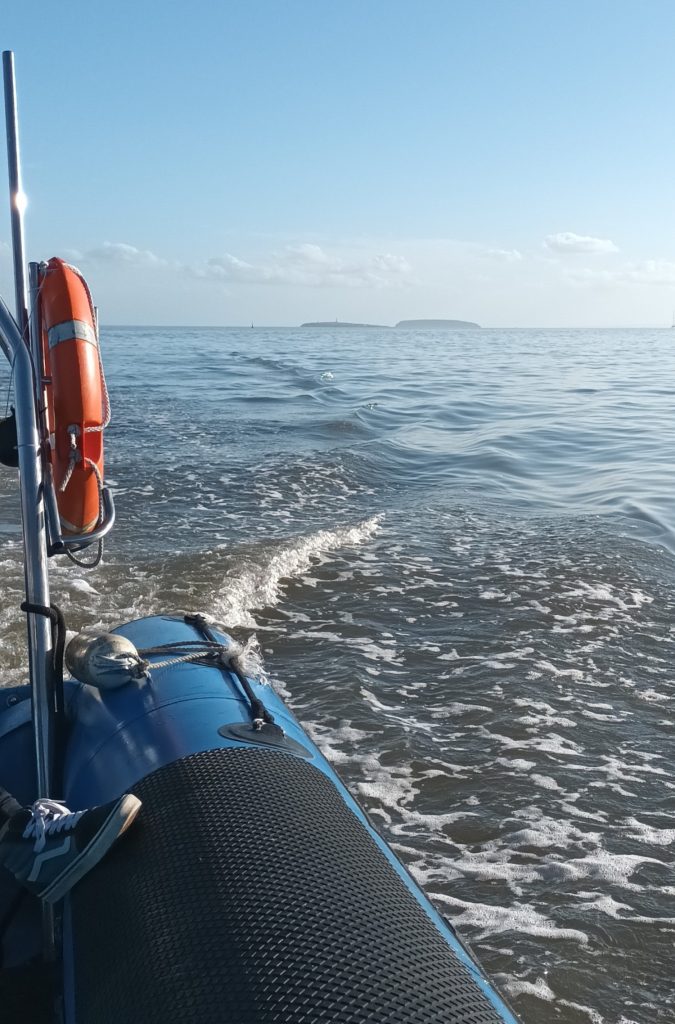
All at sea: fast forward into the Estuary
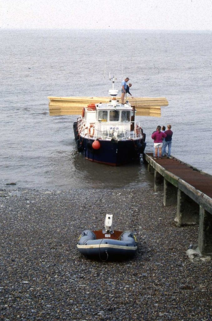
Roof trusses ready for unloading on the MV Lewis Alexander, 1990 (photo: Dave Worrall)
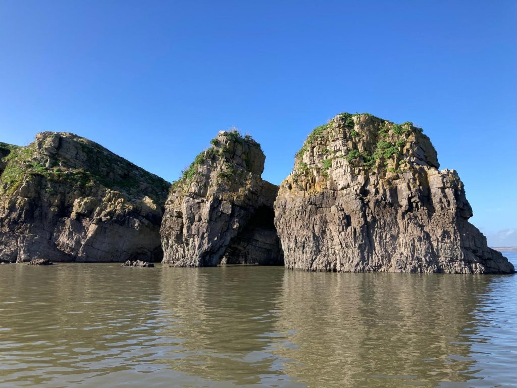
The impressive grey-white cliffs of Castle Rock on the northern shore of Flat Holm
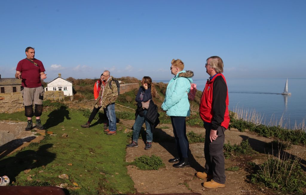
Our group of day visitors listening intently to the tour given by Steep Holm’s warden
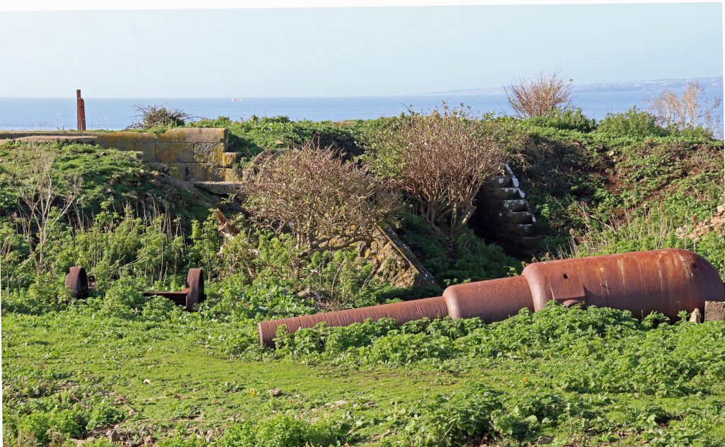
Remains of military hardware lie silent and unused
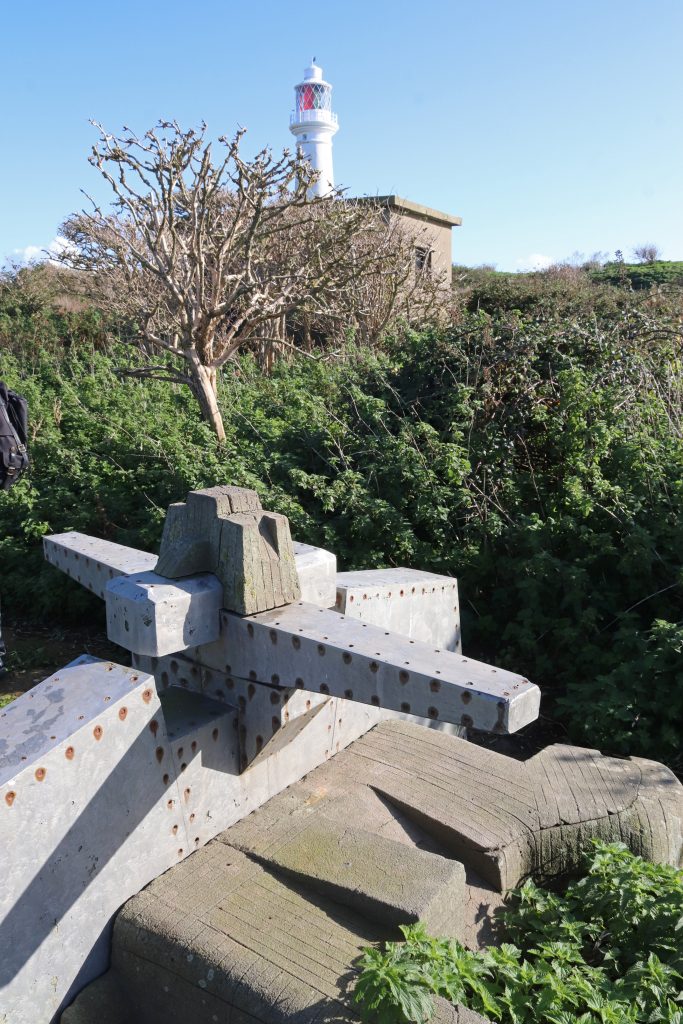
A celebration of the first-ever radio transmission over water in 1897
Island heritage and history
As we walked along grassy paths through the gentle slopes of bracken and scrubland to the other side of the island, we began to realise this was no toy town, neatly planned island, the stuff of story books. Instead, there was a seemingly haphazard assortment of historical artefacts, from rusting military paraphernalia hugging the island’s shores to farmsteads and other buildings in various states of disrepair strewn across the island. As we learnt from our tour and a quick visit to the museum (a v busy room housing a few curiosities and display boards in the old barracks) many of these remains are indeed cultural treasures which help tell the island’s unique and sometimes troubling story.
The tour guide whisked us through the centuries. He told us about the island’s important strategic position and defensive role, not that we needed much reminding given the amount of military detritus lying around. From Victorian barracks and the remains of a Second World War radar system to a labyrinth of wartime bunkers and tunnels, there’s plenty for visitors to explore. There’s even an eighteenth-century cannon and four major gun emplacement sites. The latter form part of the Palmerston Forts, a chain of defences around the British coast to deter the French from invasion, when Anglo-French relations were deemed somewhat strained and there was increasing concern about the strength of the French Navy. Whilst never used and grossly expensive, these Palmerston Follies, as they’ve been sometimes been, are quite a tourist attraction. They may be even paying back some relatively meagre financial rewards. We were shown the Lighthouse Battery with its Moncrieff pit, an ingeniously designed stone pit for a huge, ten-tonne, disappearing gun. We were even allowed to explore this sunken gun pit and some of the surrounding stone tunnels, much to the delight of many in our group.
Then we were taken to see an outdoor arts exhibit nearby which commemorates the first-ever radio transmission over water, between Flat Holm and Lavernock Point. Almost hidden by surrounding bushes and stunted trees, this sculpture is considerably more low-key than that recently unveiled in Cardiff Bay, a twelve-foot-high wooden analogue radio! May be just as well for Flat Holm, given Marconi’s supposed and misguided links with Mussolini’s Fascist Party prior to World War II. However, global communications wouldn’t be the same today without these humble beginnings of wireless telegraphy, and it’s thanks to the persuasive powers of George Kemp, a Cardiff-based Post Office engineer, that Marconi set up his experiments here anyway.
By contrast, I found the lighthouse so much more impressive. Standing 30m above the ground, it’s clearly visible across most of the island, offering far more photo opportunities than I could possibly exploit on such a short visit. Today, the lighthouse lay dormant with only its elegant clean white sides dazzling against the bright blue sky. Very different to the many times when it’s given me a distant, friendly wink as I’ve looked across the estuary in early evenings at Penarth. Now that I was so close to this landmark, which has consistently followed me around my visits to the Outer Estuary, it seemed strangely familiar and almost homely. It was also reassuring to think that there’s been a Trinity House lighthouse here since 1737, although it’s been refurbished many times, once even after lightning struck in 1790. What a relief it must have been for sailors in the past, and even now, to see its lights on approaching the notoriously treacherous waters of the Severn. However, even with this lighthouse and the foghorn, occasional ships have foundered in the waters around here, including the sloop, the William and Mary. This incident, which tragically resulted in the loss of fifty-four lives back in 1817, seemingly arose more from ‘human error’ rather than meteorological causes, given it was clear and calm on the night in question.
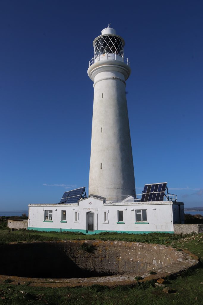
The unmanned Flat Holm lighthouse with a Moncrieff pit (for a disappearing gun) in the foreground
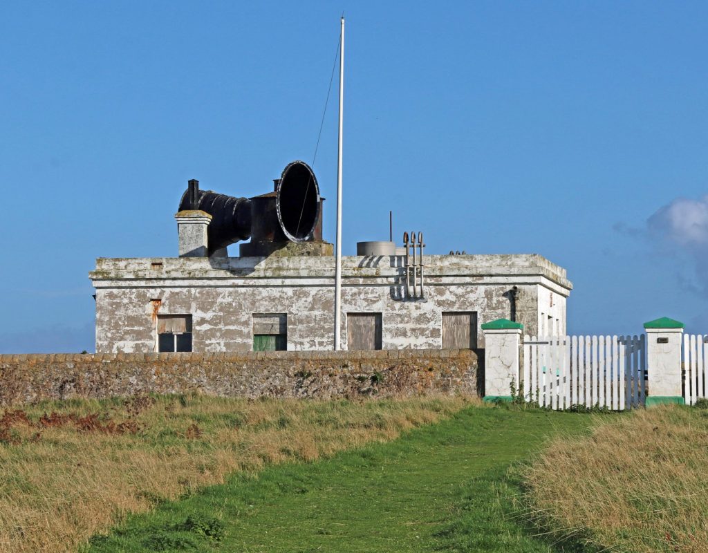
The disused foghorn, now a silent partner to the lighthouse, was restored by the Flat Holm Society in the 1960
After the tour, we explored a few more sites for ourselves. Unfortunately, time was getting limited, and we didn’t want to miss the one and only boat back, so we could only view the old farmhouse from a distance. Now the island’s social hub and home to the warden and volunteers, these tidy, white-washed buildings would once have been the centre of the island’s farming community before the turn of the nineteenth century when they were converted into the short-lived Flat Holm Hotel, replete with bar and skittle alley. Fortunately, we did just have time to quickly sketch and photograph the silhouetted chimneys and derelict remains of the abandoned cholera hospital. In use from the late nineteenth to the early twentieth century, this had defended the City of Cardiff, not from a military invasion, but from the throes of this terrible disease, brought here by unfortunate seafarers who’d travelled the globe. Strangely alluring and photogenic, I struggled in the silence of mid-afternoon sun to imagine the cries of the poor souls, afflicted with cholera, who’d been kept in isolation here. I do so hope that Natalie’s dream world will come true and that eventually the cholera hospital will be fully restored. I’m not so sure about the buzzing residential visitor centre which she imagines, but some further recognition of these unsung heroes, particularly the amazingly dedicated and brave staff who’d worked here, would be good.
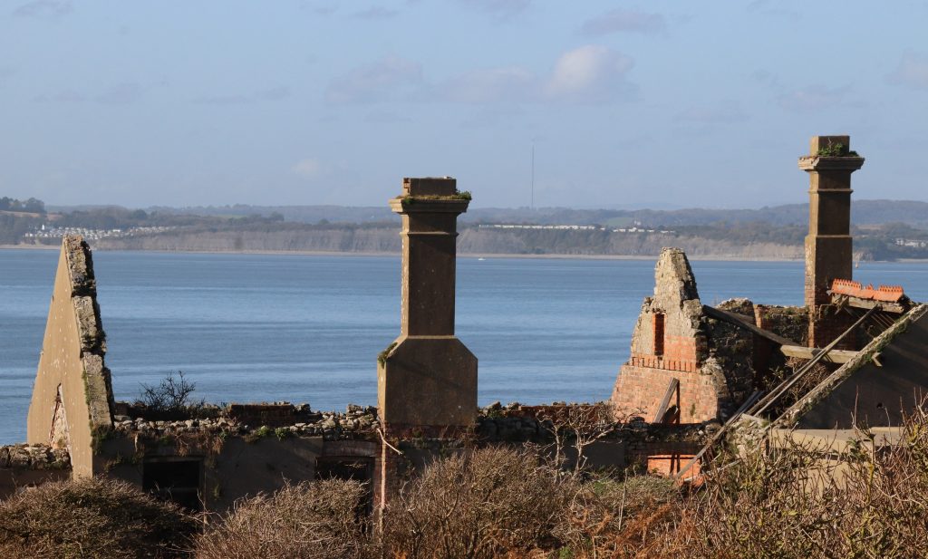
The dilapidated remains of the old cholera isolation hospital with views of the Welsh coast in the distance
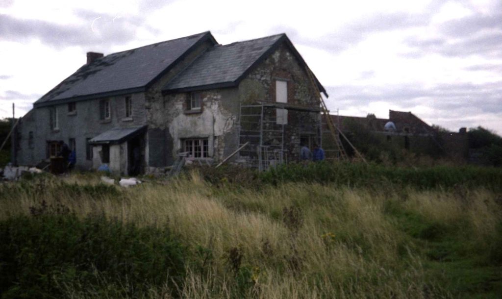
Before – the farmhouse during renovations in the mid-80s
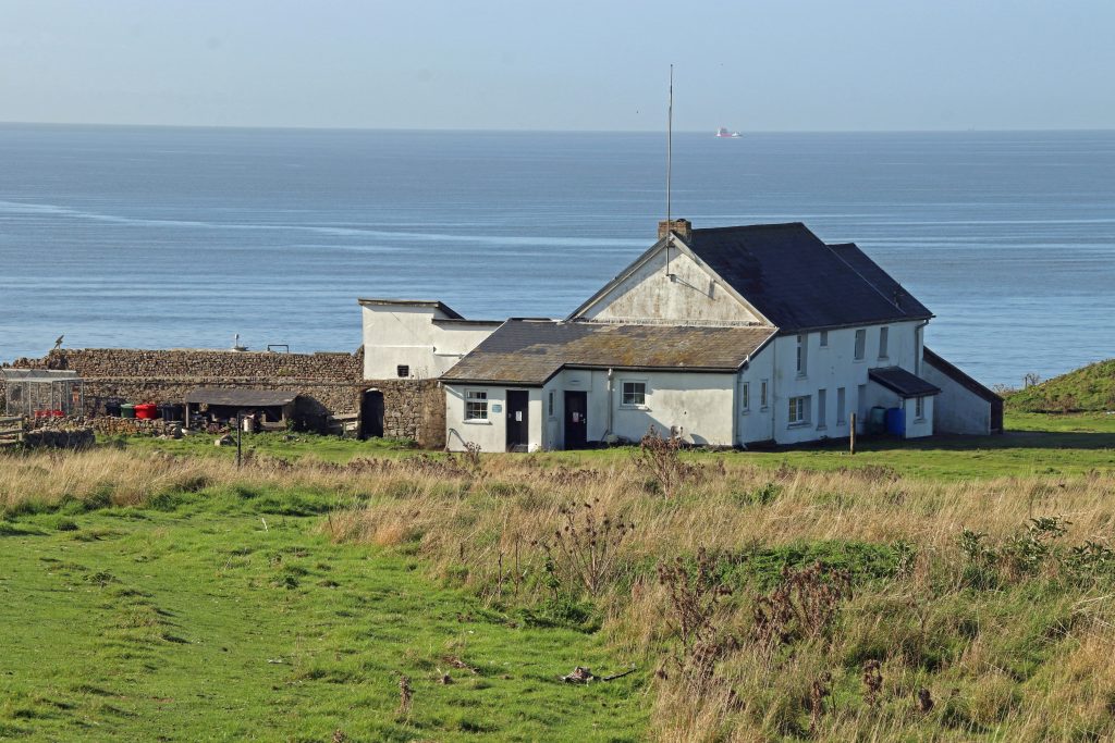
After – the farmhouse as the current island’s social hub and home to staff
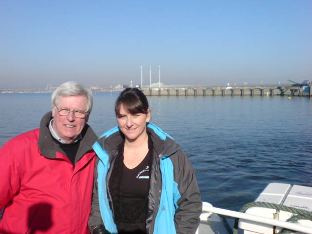
Natalie meeting with John Craven to feature on Countryfile
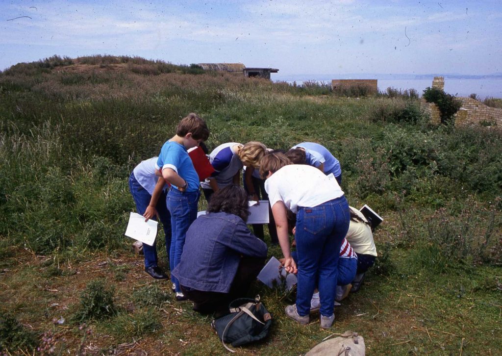
An early school group helping with monitoring surveys in the late 80s
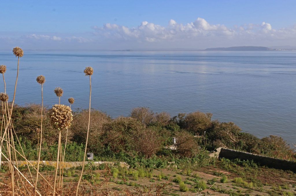
Wild leeks grace a view across the still waters of the Channel towards the North Somerset coast
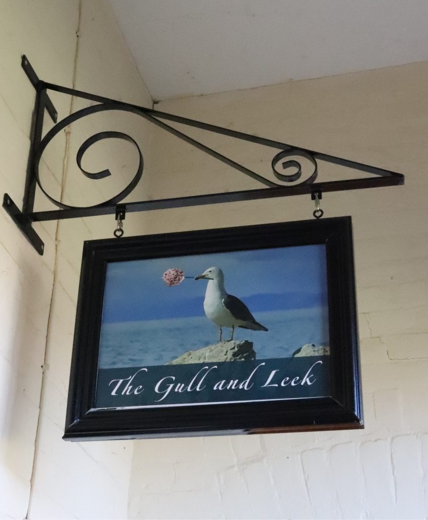
The Gull and Leek, the most southerly pub in Wales
The island’s natural environment
Prized for its wildlife interest and being a Site of Special Scientific Interest and Local Nature Reserve, we had arrived with great expectations. But late autumn doesn’t make for a nature safari: the gulls, including the lesser black-backed gulls (Larus fuscus), for which the island is famous, had left several months ago. At least no hard hats were required to cross the island this time – I distinctly remember my last visit years ago, struggling to cross the island, huddled under jackets, trying to avoid the constant attacks from dive bombing gulls. In stark contrast, this time, we were treated to a few moments of solitude and island magic as we contemplated our lunch spot, gazing out across the serene blue waters of the Channel. No wonder so many have been lured to the island as a retreat, from the Vikings to the Celtic saint, Saint Cadoc who lived on the island in the 5/6th century. Even our three former Flat Holm wardens still treasure their memories of feelings of ‘remoteness and isolation.’ Dave comments that it was the combination of the ‘island’s remoteness, isolation, it’s fascinating natural and cultural heritage, whilst also being in sight of the capital city of Wales and in the middle of a busy shipping lane for those using the ports and harbours of the Severn Estuary,’ which made it such a special place for him.
As we sat eating our lunch, we were enchanted by the sound of waves lapping gently along the shore, only rarely interrupted by an occasional bird call from the elusive water rail (Rallus aquaticus) and the rustling of dried bracken, as rabbits hopped by only feet away. Fortunately, for me, with my phobia of snake-like creatures, we didn’t see one of the island’s unique slow worms (Anguis fragilis), famous for their large blue markings. Mercifully, neither did we encounter the rare special flesh and bone-eating beetle (Dermestes undulatus) which holds on here as its last stronghold in the British Isles. With such rare and important species, it’s heartening to know that there’s an active management programme on the island, the Flat Holm Project. This project, which has been going on for decades, makes its mission to try to conserve the island’s important natural and cultural features. It’s a real success story. It’s featured on national TV, as Natalie Taylor, who’s in charge of projects including the Flat Holm Project for Cardiff Council, is keen to point out. However, for me its main success lies in its long-term monitoring of the natural environment. Through regular monitoring in all weathers and conditions, project staff, helped by armies of volunteers, having amassed an invaluable and enviable amount of quality data. From spring gulls counts to invertebrate and litter surveys, there’s data, and, now, as I understand you don’t even have to go to Flat Holm to explore some of the wildlife data (see: BBC News). Using an interactive digital map in Cardiff’s Techniquest science museum you can now access data updates on flora and fauna – all in relative warmth and comfort and without even having to worry about whether you’ll get cut off by the tides. A great development which provides yet greater access to even more people.
We enjoyed our brief encounter with the island’s nature over lunch, short though it was. Many of the cliff tops were graced with beautiful displays of autumn colour. Most memorable were the stately seed heads of the rare wild leek, Allium ampeloprasum. I certainly agree with Peter Finch’s description of them as ‘triffid-like and magnificent.’ On our visit their slightly dishevelled pompoms rose a metre or so above the cliff tops, framing spectacular views of the Channel behind and affording me lots of photo opportunities, as you’ve probably guessed from flicking through this article! No wonder too that this is Cardiff’s County flower and part-inspired the name of the island’s only pub, the Gull and Leek.
I must share with you some of Jan’s reflections as I think they provide a slightly different interpretation of what we mean by an island’s ‘natural’ environment here. Jan Lesley Powers, who was Flat Holm Project Assistant in the late 90s and our previous SEP Manager, comments on how the wildlife here ‘has responded to human interference and holds some of the island’s history’ and points out that, unusually, Flat Holm has wildflowers which generally only grow in sandy soil. Apparently, these plants owe their entire existence here from their seeds being inadvertently transported in sacks of sand by soldiers billeted here during WWII. She also told me that rabbits only thrive on the island because they were introduced for farming in the twelfth century, presumably by the monks from St Augustine’s Abbey in Bristol, who established a dairy farm and grange on the island in 1150. Perhaps less known has been the link between the gulls on Flat Holm and the large urban landfill sites around the estuary. Compared with today’s gull populations of about 1500 breeding pairs of lesser black-backed gulls (Larus fuscus) and herring gulls (Larus argentatus), there were as many as 4000 breeding pairs of these gulls at their peak in the mid-seventies (SSSI citation), supported by rich pickings from the many uncapped landfill take-aways around the estuary. Protected by overalls and helmets, Jan recalls some of the ‘crazy things’ which she, other staff and volunteers discovered in nests during the annual gull counts each spring. ‘… plastic doll body parts …and even a whole polony sausage!’ Sadly, she notes ‘the gulls often suffered and died from botulism (not a type humans could catch) after eating rotting chicken carcasses from the landfill sites, particularly in warm weather, and especially once black bin bags were used, when it worsened.’
New perspectives
Having finished our lunch, we spent a few moments savouring the spectacular wide-open vistas of the Estuary and Channel from our unique vantage point. Hopefully, these pictures capture a little of the essence of these views. As I watched sailing boats gracefully glide across the water, I reflected on how boundaries drawn up for management purposes might appear somewhat arbitrary and theoretical. However, since my involvement with SEP, I’ve been very aware of the importance of this location from a management point of view. I also was reminded of what is generally regarded as the technical edge of our estuary, an imaginary line between here, Steep Holm, Lavernock Point and Brean Down. Indeed, this represents the approximate seaward limit of most of SEP’s interests. It also marks the edge of the estuary for other management purposes, particularly related to water quality and natural coastal processes. In this context, the exact position of this boundary has been the subject of many an academic article. It hasn’t gone uncontested by local communities either, who’ve frequently identify winners and losers across the boundary divide. This imaginary line is also now very much in my mind, as SEP Chair, given that the Severn Estuary Commission is currently exploring the potential for sustainable energy from the estuary’s tides for the Western Gateway pan-regional partnership. As the Commission has no capacity to do new research and has to rely more-or-less entirely on previous evidence, I gave more than a passing thought to the conclusions of the 2010 Severn Tidal Power Feasibility Study as I looked across towards Steep Holm. This study’s report suggested a ‘Cardiff to Weston Barrage’ was ‘feasible.’ Was I looking at what would become an historic landscape?
Returning across the island at pace, hopefully by the same grassy paths as earlier, we were relieved to find the one and only signpost on the island, reassuring us of the route back to the jetty (not that there weren’t some obvious landmarks easily visible all around us!) With a little time in hand, the signpost became a key photo-opportunity and talking point for us and our fellow travellers – clearly, we’d all been bitten by the magic of the island and were intrigued by our new offshore orientation! Even though I’d been aware of the origins of name Holm (which means ‘island in an estuary’ in Old Norse), I certainly didn’t know that there is another island with a lighthouse, with an almost identical name, Flatholmen, off the coast of Norway
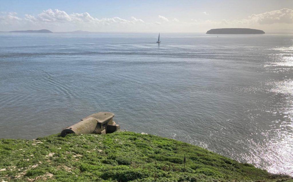
Looking across the Channel towards Steep Holm
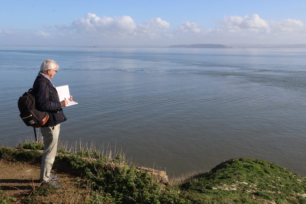
An artist’s paradise – sketching the view towards Brean Down in glorious sunshine
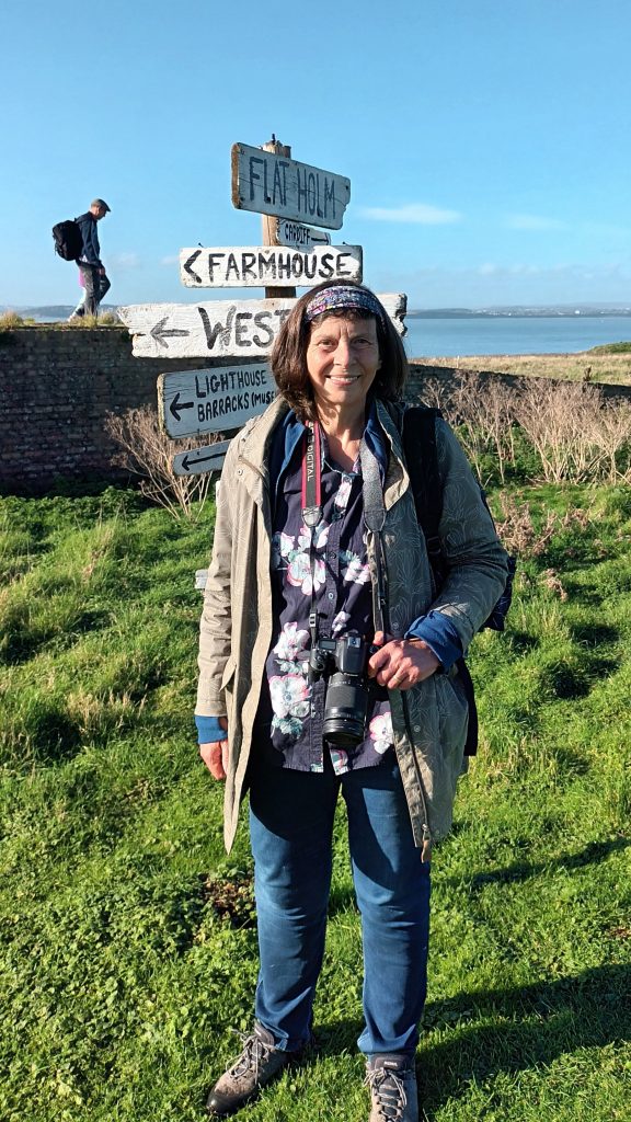
Relieved to find the one and only signpost on Flat Holm
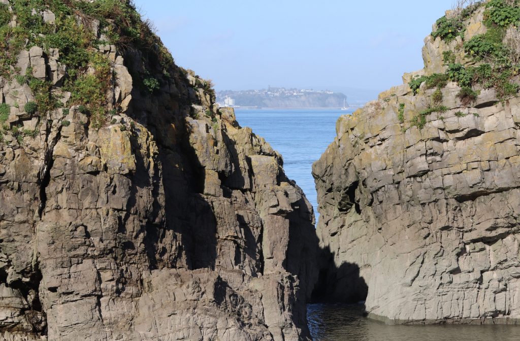
A glimpse of the Penarth coast between the mighty limestone cliffs at Castle Rock
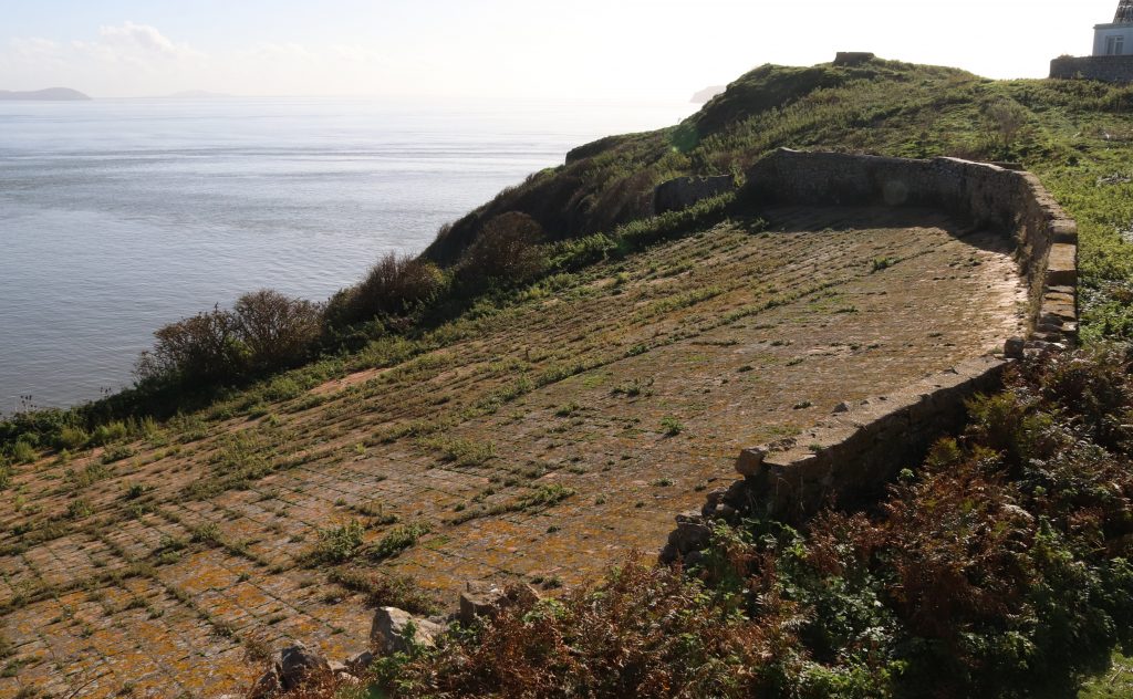
The stone-clad water catchment, supplying the island with freshwater
Some final reflections on island challenges
As we approached the jetty area, we passed a small flock of endangered Boreray sheep. These shaggy, almost feral beasts were introduced to the island from Scotland a couple of years ago. The hope is that these new grazers will create ‘critical nesting sites’ for the declining lesser black-backed gull colony, but I hope they won’t suffer from lead poisoning either. Unfortunately, the seemingly wild grasslands are not as pristine as you might think. A legacy from former silver mining has left some island soils polluted with lead and other heavy metals. This means that the land is suitable only for grazing for land management and not for food farming possible, even centuries after the short-lived mining activities ceased. Human endeavours to stem other pollution-related issues on the island have met with varying degrees of success. The restoration and capping of some of the massive urban landfill sites, such as Lamby Way and Ferry Road in Cardiff, over the last few decades, must have stemmed the botulism issue. However, there’s still a constant tide of litter despoiling the island’s shores every day according to the staff member who was waiting to see us safely off the island. Amongst the items picked and recorded each month are lots of plastic dog toys, presumably mislaid by dog walkers on local beaches. Messages in bottles and creepy dolls have also been found alongside a miscellany of other plastic discards from modern society.
However, it’s the day-to-day existence on this remote isle, with its exposed climate and extreme tides, which creates the biggest challenges for those living, visiting or indeed often just visiting Flat Holm. Looking down the steep steps towards the jetty it was clear that even providing basics, such as drinking water, power, heating, food and waste disposal, never mind internet access, is fraught with difficulties and logistical problems. Natalie, who was the warden for several years, informs me how power, heating and water have to be ‘managed carefully, because we have no mains services and have to rely on PV (photovoltaics – solar energy), driftwood, rainwater and back-up gas and generators.’ Clearly, even just staying warm can be challenging at times and the weather dictates how much power we generate.’ Natalie even recounts her memory of listening to the shipping forecast on the VHF especially on those dark, windy, rainy wintry days early in the morning was really comforting.’ Slightly difficult to imagine on our visit on such a calm and warm autumn day! Dave remembers the hard times before the water catchment area was renovated when they had to transport the island’s entire water supply in water jacks. Nowadays, fortunately, the island’s water supply comes from an ingenious and impressive water catchment area, which we’d been able to see first-hand earlier in the day. This mighty stone-clad structure catches rainwater which then runs down slope to feed a large underground storage tank housing the island’s water supply. Waiting for our return boat, one of the current Flat Holm staff somewhat sheepishly told of us of the team’s excitement when a Chinook helicopter once did an extra special pizza delivery whilst officially doing a practice landing on the island. I’m sure such guilty pleasures are forgivable though, as life on Flat Holm, whilst only four miles from Cardiff, is pretty tough at times, especially in the long dark winter months.
Final thoughts
As we skimmed across the water away from Castle Rock, it wasn’t difficult to imagine the ships which had run aground or the smugglers who’d plagued the island in previous centuries. Within minutes, however, these thoughts and the wildness of Flat Holm seemed so far away as we stepped back onto the busy quayside in Cardiff Bay. However, my head was still buzzing with thoughts about the island and its future, especially given its inherent vulnerability, lying so close to Cardiff and the other urban centres around the Estuary. Although Flat Holm has been described by Wyn Mason as a ‘wild haven in a human-centred world’, humans have already made a significant and lasting impact on this small isle. Indeed, all the previous warden have expressed to me their concerns about future pollution and climate change impacts. And yet, perhaps surprisingly they were all relatively hopeful about the island’s future, as am I. As I’ve realised from my visit, some really creative innovations have been stimulated by tackling the island’s challenges. The hope is that new sustainable solutions will continue to be developed here and that the fine balance between hosting visitors, like me, and the island’s ecological needs will continue to be maintained. As Natalie stresses, we certainly need people to show an interest in ‘maintaining safe and thriving environment and caring about nature and heritage here.’ May be the island will become that sustainable icon and a ‘prime example of sustainable living’ and ‘beacon of nature conservation, heritage and educational opportunity’ and an ‘ongoing retreat centre for those wishing to have a respite from modern life and amenities’, as Natalie, Dave and Jan hope.
I recommend a visit if you’ve not been there before – it really will change your perspective of the estuary and your place in it. Before you go, I’d suggest you explore the Flat Holm Art Project’s website, which Natalie’s rightly proud of. Here you can undertake a 2D tour of the island’s landmarks as well as enjoy a wealth of poetry and other place-based art, inspired by the island and its heritage. There’s even the Singing Lighthouse, a sonic odyssey, of intriguing sounds recorded on a visit from Cardiff – and it’s nearly as good as going there in person! I certainly hope we’ll be brave enough to visit in person again, but next time during the gull season, earlier in the summer, when we’ll also be able to see the wild leeks and the rock sea lavender in bloom and may be even have time to visit Wales’ most southerly pub.
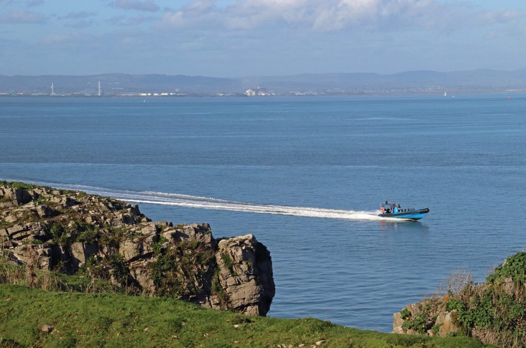
The Celtic Pioneer returning to Flat Holm to take us back to Cardiff
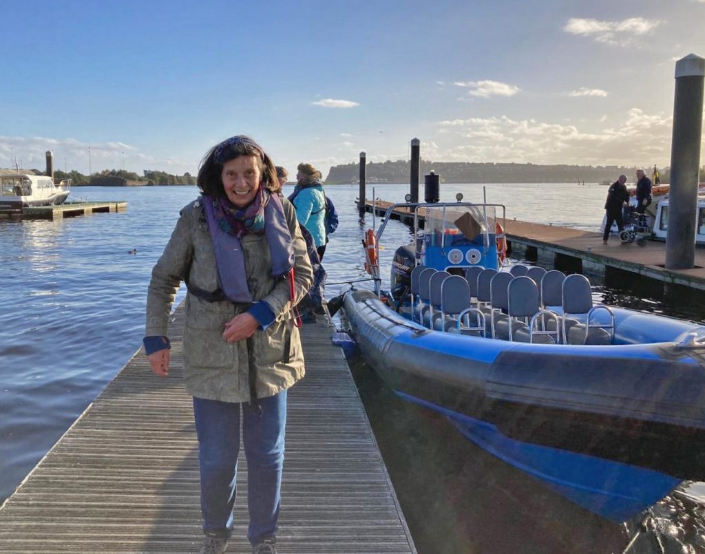
Back ashore in Cardiff Bay, delighted with memories from my retirement present (photo: Geoffrey Ballinger)
Where next to discover some unexpected connections across our estuary’s shores, I wonder?
A few more interesting websites on Flat Holm
Cardiff Harbour Authority’s Flat Holm Project website – https://www.cardiffharbour.com/flat-holm-island/
The Flat Holm Art Project – https://art.flatholmisland.com/
Flat Holm Society – https://flatholmsociety.org.uk/
The Mary Gillham Landscape Project: Flatholm – https://www.marygillhamarchiveproject.com/landscape/flat-holm/
The fortified island of Flat Holm (2021) – https://www.walkingthebattlefields.com/2021/10/the-fortified-island-of-flat-holm.html
Online descriptions of island life from the current Flat Holm wardens – https://www.bbc.co.uk/news/uk-wales-61507679
 Severn Estuary Partnership