Aust Cliffs to Severn Beach: reflecting on the passage of time
Aust Cliffs to Severn Beach: reflecting on the passage of time
Written by Dr Rhoda Ballinger, SEP Chair
Rhoda delves into deep time at Aust Cliffs, visits four estuary crossings from different periods and reflects on coastal change and flood risk around Severn Beach.
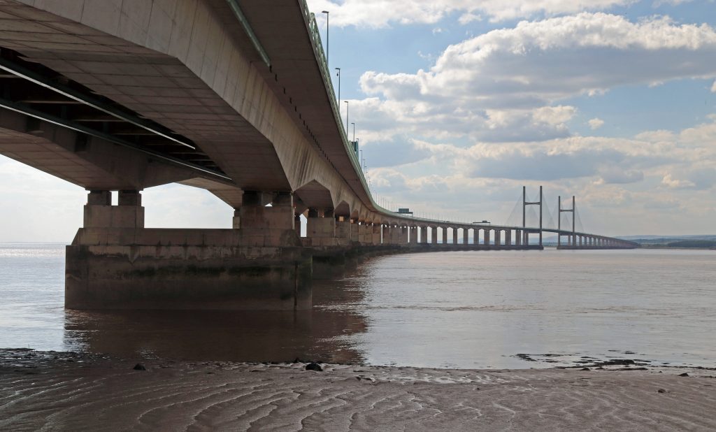
Photo: The Prince of Wales Bridge crossing over some of our estuary’s most treacherous waters
Introduction
Since becoming SEP Chair in April 2024, I realised I’d completed a dozen walks, but hadn’t yet explored the shores of several local authorities around the Estuary. With this in mind, I decided to focus my next few walks on filling those gaps. So, this month, having heard about various management projects along the South Gloucestershire coast in recent SEP meetings, I decided to explore the shore between Aust and Severn Beach.
On one of those fine sunny days in early May, I ventured out with Geoff, my husband, to explore the shore between the bridges on the English side of the estuary. Once again to inform my article, I’m grateful to the members of the community for sharing their rich local knowledge and history. Val George has been involved with the Pilning & Severn Beach History Group since its inception in 1999 and Alderman Peter Tyzack, vice-chair of Pilning and Severn Beach Parish Council, is no stranger to SEP, having been Chair of our Steering Group.
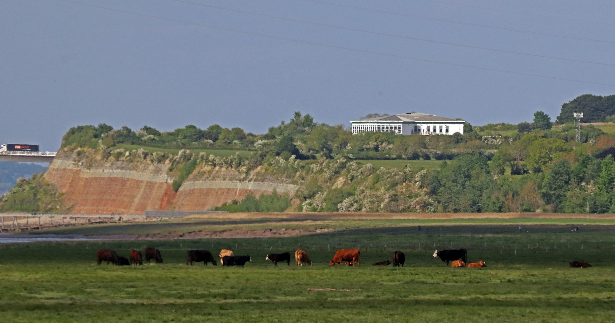
Photo: Cattle grazing on the marshes in front of the iconic Aust Cliffs

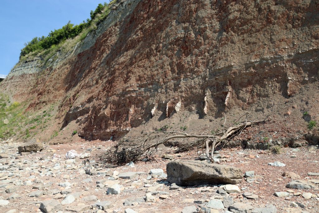
Photo: The impressive Aust cliffs showing evidence of active erosion
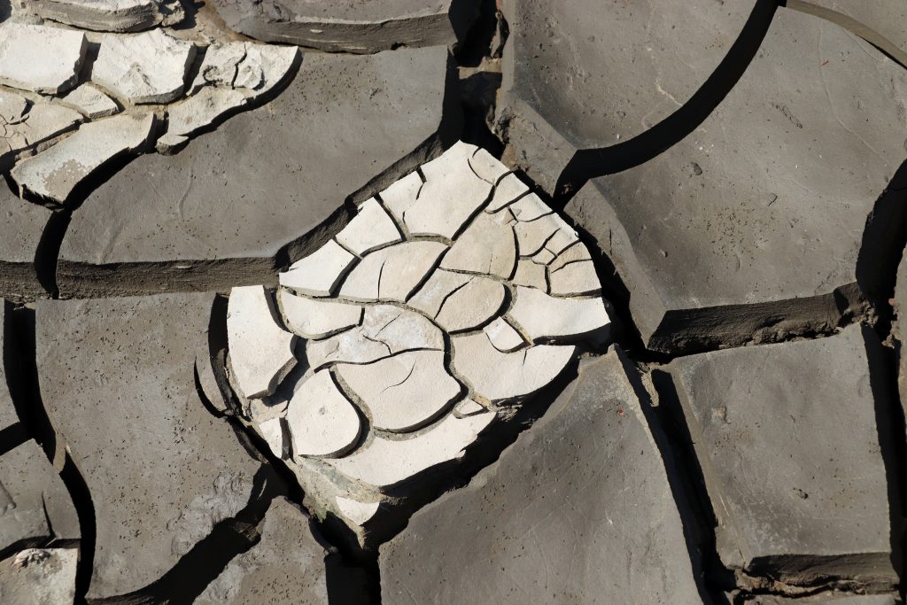
Photo: Mud cracks on the current foreshore

Aust cliffs – a glimpse into deep time
We started at Aust Cliffs, the sister site to the Penarth-Lavernock shoreline which I’d visited on my first e-news walk. I was especially excited to visit these cliffs, renowned for their geological significance. Designated as a Site of Special Scientific Interest (SSSI), they offer one of the most remarkable records of environmental change from around 210 million years ago, when rising seas flooded a once-arid desert landscape. These days they’re a mecca for fossil hunters, containing the famous ‘Rhaetic Bone Bed’ with its incredible wealth of remains of fish and marine reptiles/ dinosaurs. What might we find?
As we neared the shore, the towering cliffs rose above us, showcasing a striking sequence of coloured strata—from red and green marls to cream and white limestones—that was truly impressive. From a distance, it might have looked like a giant slice of sponge cake, but up close, there was fascinating geological detail. White veins jutted out from the ancient red desert rocks, resembling the worn, jagged teeth of some long-lost giant beast. These were made of gypsum, formed when highly salty water evaporated in shallow, temporary lakes (playas), similar to what occurs in the Dead Sea today. Glittering chunks of gypsum lay scattered across the shore like discarded chess pieces, having tumbled from the cliff face above. As we continued along the beach, carefully skirting recently fallen trees, I questioned the official claims of ‘slow’ erosion—prompting me to take a cautious step back. Later, I also wasn’t surprised to learn that for reasons of safety the first classic sketch of this cliff in the 1820s, had been made from a rowing boat offshore!
The beach here quickly morphs into soft mud – and, determined not to have another Severn Estuary mud immersion experience after my Severn Bore visit, I focused on studying treasures within the mid-shore. To my surprise, the muds were a spectacle in themselves. Mud cracks, formed from the drying out of mud as the tide had waned, had created a fascinating display of intricate and complex polygonal patterns. From every angle there was a cubist masterpiece – a shame our visual artist friend, Heather Green, who studies and draws inspiration from our intertidal areas, wasn’t with us.
Having exchanged a few words with a couple of fossil hunters, who were leaving with a plastic bag of goodies, we scoured the beach. No sharks’ teeth or bones from dolphin-like ichthyosaurs and long-necked plesiosaurs today. We had to make do with observing a motley collection of marine shells—mostly fragments of oysters and scallops—from boulders that had fallen from the cliff. With little time or expertise, we couldn’t examine the site’s renowned fossil insect deposits—the richest Triassic insect locality in Britain. As a small consolation, though, a pair of peacock butterflies performed a brief pas de deux as we left.
Old estuary connections: The Severn Bridge and the Old Passage
We carefully negotiated our way over a sea of boulders to get a rare view of the undercarriage of the bridge, now definitely a senior, at sixty years old. Here, it was at its most impressive, rising elegantly above the still, brown waters of the Severn. However, whilst the photo might suggest a peaceful, tranquil view, we struggled to appreciate the scene against the constant roar of traffic. More disturbing, however, is the news today, that new weight restrictions have come into force on the bridge. Hopefully, a technical solution will be developed soon to keep this vital bridge safe and functioning.
Moving along the shore toward Old Passage, there were more mud cracks, mysterious wooden structures jutting out into the water, and countless views of the bridge—keeping my camera busy the entire time! Before too long, the boom of motorway traffic gave way to the enchanting calls of reedbed birds and the graceful reeds, wafting gently in the light breeze, provided ever more photo opportunities.
We emerged out of the reed beds to spot the decaying wooden skeleton of the old slipway, which stretched across the marshes and mudflats before disappearing into the calm, brown waters of the Severn. This was the site of an ancient estuary crossing, dating back at least to Roman times—or possibly earlier—serving as a vital, though sometimes treacherous, link between Aust and the Beachley Peninsula. Given the calm still waters on our visit, it was difficult to imagine how perilous this crossing had been. Despite fatal accidents, a small car ferry had operated here until the Severn Bridge opened in the 1960s.
Memories of the ferry terminal live on, immortalised by Bob Dylan’s visit and featured on one of his album covers, as well as in the 2005 documentary No Direction Home. In my husband’s family album, there’s also a photo of the MV Severn Queen—one of the last ferries to serve here along with her sister ship, the MV Severn Princess, which carried Dylan across the estuary. No longer here, but now lying at rest on the other side of the estuary at Chepstow, we had to make do with exploring what remains of the slipway structure and its rusting artefacts.
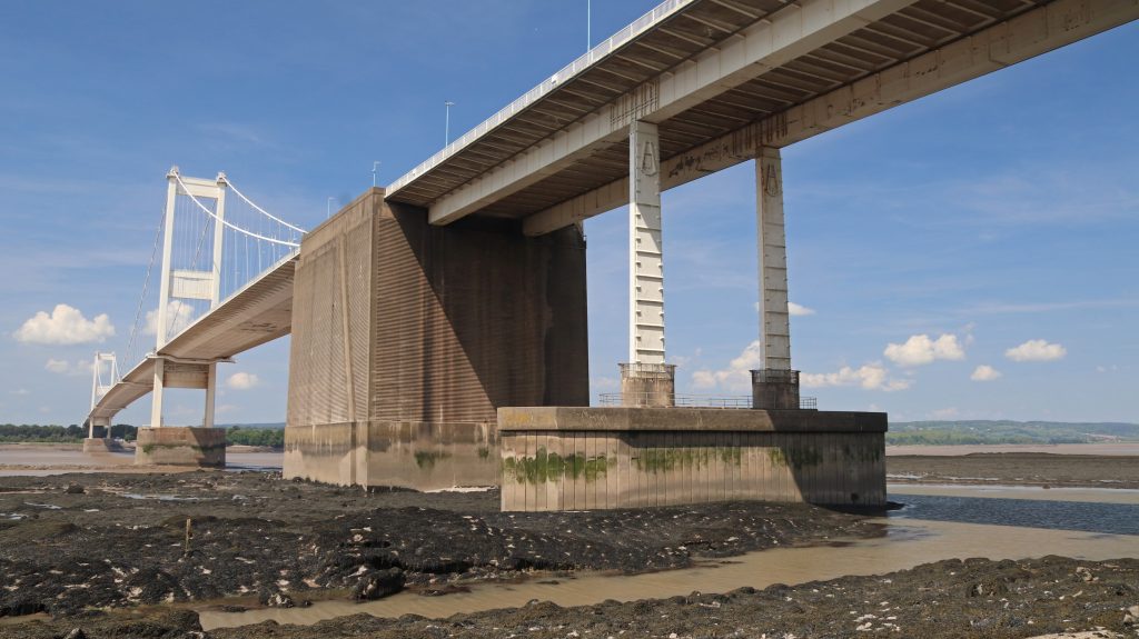
Photo: A rare view of the undercarriage of the Severn Bridge at near low tide
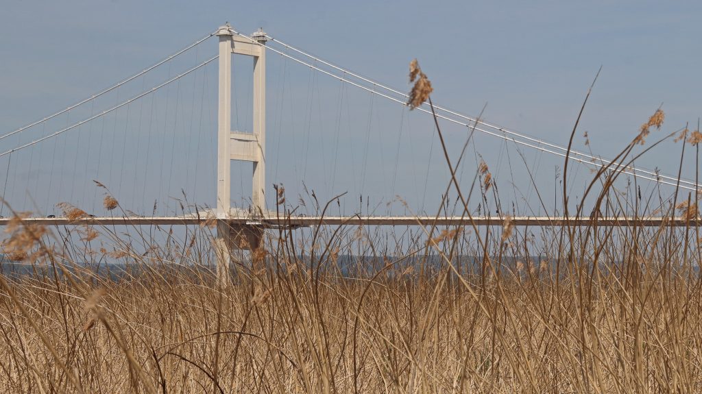
Photo: Looking through the reed beds back at the Severn Bridge
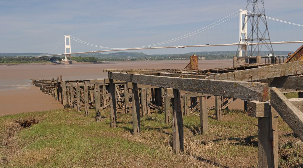
Photo: The wooden remains of Old Passage, marking the former ferry route across the Severn
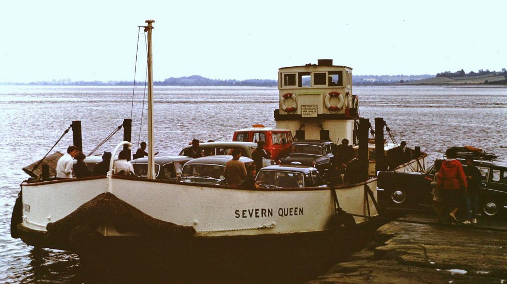
Photo: MV Severn Queen, one of the three last ferries to use Old Passage (A.L. Ballinger)
Between the bridges – agriculture and ecology dominate
Along Passage Road and further on along the Severn Way atop the flood embankment, we enjoyed some ‘typical’ estuary landscapes – great wide-open vistas across broad, low-lying verdant marshes with distant views of the bridges. There were also wonderful hedgerows, adorned with frothy white cow parsley and extensive patches of white scurvy grass brightening up the marsh edges. Agricultural pastureland gave way to conservation areas, including the Pilning Wetlands, created and relandscaped from sections of the old military firing range and sheep grazing fields at Northwick Warth. Here, as the website suggests, a telescope would have been useful. I just made out a flock of Canada Geese, but frustratingly, the distant waders and dabbling ducks eluded me. In season and with proper equipment, I’m told you can spot a wide variety of birds here, including curlews, dunlin, and snipe. Indeed, over two hundred different species have been recorded including rare Glossy Ibis and Red Necked Phalarope. No wonder so many birders were out and about!
As we approached New Passage, I was delighted to be able to recognise a couple of shelduck resting on the muddy banks of Chestle Pill, a deep tidal creek which meanders across the marsh. The scale of the extensive engineering around the creek pointed to serious flood risk concerns though. As I later discovered the recent multi-million-pound Avonmouth and Severnside Enterprise Area (ASEA) Ecology Mitigation and Flood Defence Project has provided for lots of new defences including innovative design features such as the see-through glass barriers you can see along this stretch.
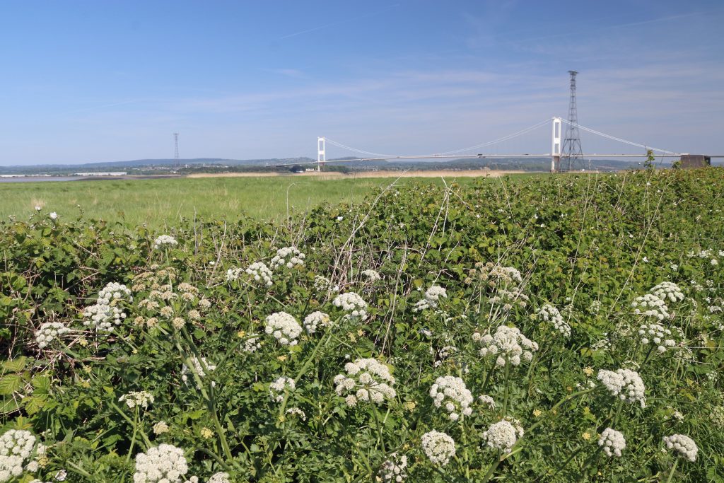
Photo: Floral interest along the way – wonderful hedgerows of wild cow parsley
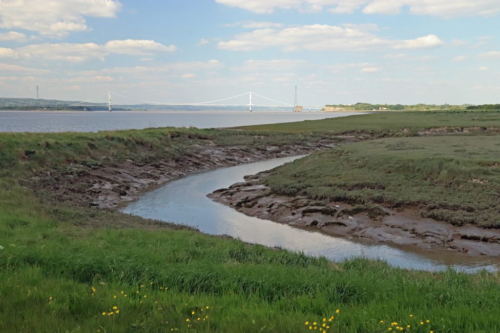
Photo: Chestle Pill at the southern edge of Northwick Warth
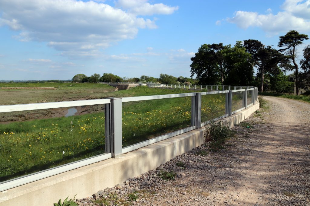
Photo: See-through coastal defences along Aust Wharf Road
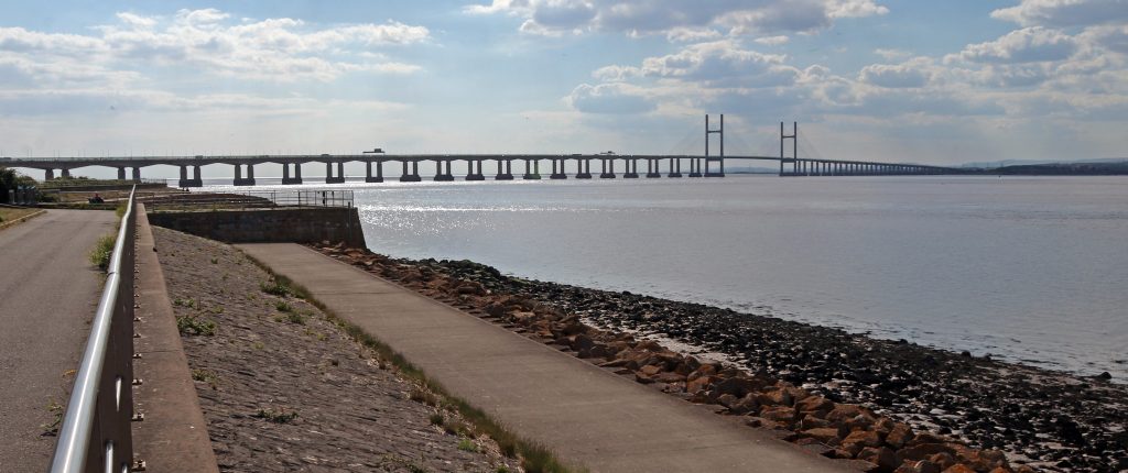
Photo: The remaining stump of New Passage with the Prince of Wales Bridge in the distance
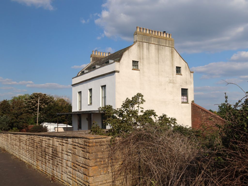
Photo: Severn Lodge Farm, one of the remaining old buildings at New Passage
More recent estuary connections: New Passage & the Prince of Wales Bridge
We continued along the path that runs atop a stark stone-and-concrete sea wall, tracing the line of the old Binn Wall—built in 1815 to replace earlier 17th-century defences. Although its appearance on 19th-century maps might suggest it was indestructible, the Binn Wall has been upgraded and raised several times in response to flooding. Today, the newly improved wall serves as a promenade, offering locals and visitors sweeping views of the Prince of Wales Bridge. As we ambled along, we noticed a small kink in the seawall. Goodness – was this New Passage? It’s certainly nowhere near as eye-catching as the relic structures at Old Passage. However, as we were to learn from the informative plaques and the New Passage Heritage Trail, its history is every bit as fascinating.
New Passage offered a more direct crossing and, although there’d been on-and-off operations here since the early 17th century, it was the arrival of the Bristol and South Wales Union Railway in 1863 that truly transformed its fortunes. Locomotives pulled carriages onto a wooden jetty stretching well out into the estuary, allowing rail passengers to easily board the ferries to Portskewett. Despite this, the crossing was notorious for its harsh conditions. Indeed, Thomas Telford famously described it as “one of the most forbidding places at which an important ferry was ever established.” Delays were frequent – so much so that a large hotel was built for waiting passengers. However, it was the opening of the Severn Tunnel in 1886 which brought ferry services here to an end. The pier was dismantled shortly afterwards. Today few original buildings from New Passage’s heyday remain although, Severn Lodge Farm—once a lodging place for visitors and notable for its impressive twenty-four chimneys— is still a local landmark.
Beyond New Passage, we eventually reached the Prince of Wales Bridge, which was even more imposing at close quarters than at a distance. Amid the roar of traffic overhead, we followed the track beneath the bridge, taking in its immense scale from this dramatic new perspective. Wow! The supporting pillars are indeed huge and the whole structure is so much sturdier than its younger upstream cousin. It’s almost as if the Severn Bridge is the graceful ballerina, and this, the tough, almost invincible rugby player. There were plenty of photo opportunities too as we tried to capture the bridge’s graceful, almost serpentine curves and its striking presence. Then, just beyond the bridge, we spotted the famous iron pipe, which, as Peter Tyzack later explained, is the outfall for fresh water pumped from the Severn Tunnel.

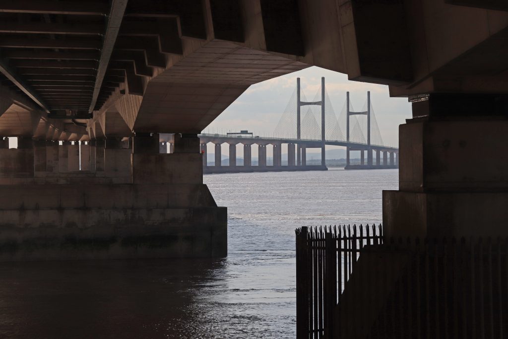
Photo: A new perspective of the Prince of Wales Bridge – from below!
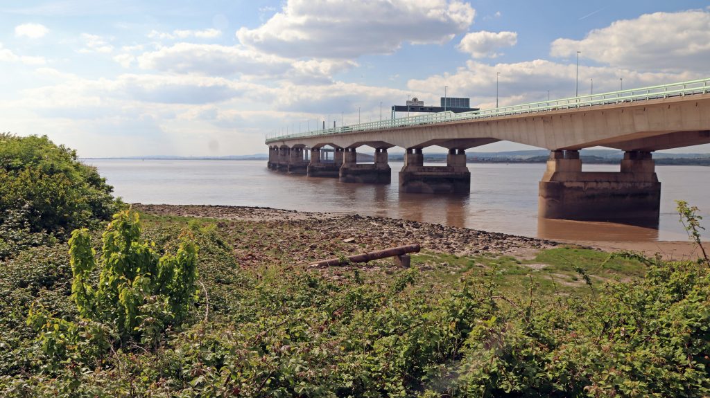
Photo: The outfall pipe from the Severn Tunnel with the PoW Bridge behind
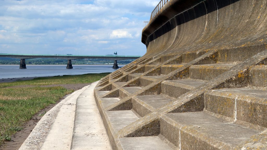
Photo: The green shore fronting the sea wall at Severn Beach
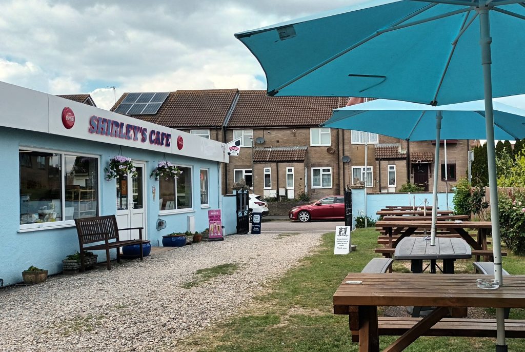
Photo: Shirley’s café – almost the sole reminder of Severn Beach’s heyday as a seaside resort

Severn Beach – Seaside tourism, suburbia and industrial change
Following the promenade, we were joined by a growing number of fellow walkers as we approached Severn Beach. I was slightly disappointed, though not at all surprised, to find it wasn’t a traditional, touristy beach. After all, this is the Severn Estuary! Instead, mud, shingle, saltmarsh and even more mud. A great haven for wildlife and birdlife though, not that we had time to study these now, having spent more than a few minutes en route gathering elderflowers to make my annual cordial. We couldn’t miss the hulks of driftwood—entire tree trunks—strewn along the shore, stark reminders of why such substantial sea defences are needed here. Nestled, perhaps even cowering, beneath the towering defences, rows of neatly laid-out modern housing estates stretched as far as the eye could see.
Severn Beach once truly lived up to its name, drawing thousands of visitors each summer—as we learned from the display inside Shirley’s Café, one of the few remaining buildings from the village’s heyday as a seaside resort. It even aspired to be the Blackpool of the Southwest! Thanks to the vision of local entrepreneurs and the opening of the station in May 1922, Severn Beach became the go-to place for day trips for people from Bristol and beyond. Development opportunities, akin to those along the Costa Blanca in the 60s, were suddenly unleashed. A grand hotel, cafés, pubs, shops and wooden bungalows sprung up. Attractions, including a fun fair, boating lake and the much-loved Blue Lagoon swimming pool, alongside donkey rides, beauty contests and dance competitions drew in the masses. There were a few issues, however—local hearsay claims that the sand brought in to improve the shingle beach was washed away by the first high tide. Then, after a highly successful second season in 194, the highest tide in over a decade caused widespread damage, turning wooden bungalows into floating houseboats. It was, however, the development of the motor car and the rise of foreign holidays in the 1960s which caused the resort’s final demise. The boating lake and Blue Lagoon were demolished in the 1970s, ironically making way for improved sea defences to protect the growing number of houses in the area.
Val and Peter, like much of the local community are certainly proud of the area’s history. We followed Val’s local history group’s heritage trail, discovering a series of informative plaques and locating key sites from the resort’s past, including the boating lake and Blue Lagoon—now peaceful, grassy seafront areas. With the current popularity of open-air swimming, some residents might hope to see the lido restored. For now, the resort’s revival includes the recently refurbished (2018) Tea Cottage and the anticipated opening of the Severn Beach Miniature Railway, later this year.
Standing at the end of the promenade, looking toward Avonmouth as our walk concluded, we took in a starkly different, more industrial landscape—where wind turbines, chimney stacks, and large factories dominate the skyline. Peter notes this area has changed quite considerably over the last few decades. Thanks to major investment in improved transport infrastructure, this area has been transformed into a key energy hub. It now hosts the 1,140 MW Seabank gas-fired power station and the Severnside Energy Recovery Centre, which converts waste into electricity enough to power roughly half the homes in South Gloucestershire. According to Peter, there’s an old outfall pipe from the 1960s Imperial Chemical Industries (ICI) Severnside Chemical Plant and fertilizer factory, which operated until the early 1990s. Apparently some of the foreground isn’t natural: Peter explains that much of it is made up of demolition waste, likely dumped there cheaply and conveniently to serve as a basic sea defence. He also notes significant accretion along the coast here, especially since the construction of the Prince of Wales Bridge. I wonder: was this an intended effect, or a lesson we should consider for future large infrastructure projects in the estuary?
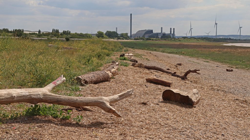
Photo: looking across the foreshore at Severn Beach towards Avonmouth

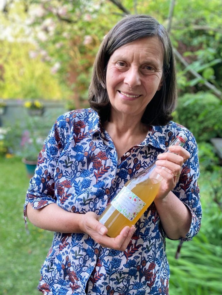
Photo: My Severn Beach/Pilning 2025 Vintage Elderflower Cordial
Further reflections and conclusions
Once again, it had been a fun and fascinating day out. What’s truly interesting is not only how much this stretch of coast has changed over the past century, but how quickly and dramatically the economic fortunes of individual communities have shifted—especially with the arrival of major transport infrastructure. While New Passage and Old Passage were made obsolete almost overnight by the Severn Tunnel and Severn Bridge, the opening of a station at Severn Beach transformed a quiet rural area into a bustling seaside resort nearly as rapidly. The impact of the longer-term economic development of the Avonmouth Severnside Development Area on this stretch of coast is perhaps a little less tangible, although demand for housing is obvious, and concerns about the possible impact of ‘huge warehouse construction on the water table’ trouble Val.
Wherever you go along the estuary, there are countless stories to be told. From my experience, you’ll always find proud locals eager to share their knowledge, concerns, and passion for their stretch of coast. The journey from Aust to Severn Beach has been no exception—both Val and Peter shared far more information than I can do justice to here. Val’s deep enthusiasm for local history and Peter’s genuine love for living on this wild coastline were truly inspiring.
Despite Val’s worries about flood risk, I’m confident that the major investments behind the ASEA Ecology Mitigation and Flood Defence Project and the new South Gloucestershire nature-recovery initiative, Linking the Levels, will help secure a bright future for this coast and its communities. Meanwhile, I have a few bottles of homemade 2025 vintage Severn Beach/Pilning elderflower cordial to enjoy—a perfect reminder of another special day spent exploring the Severn.

Further information
The New Passage and the Pilning wetlands
Severn Beach Circular via Aust and Northwick walk