Between the bridges – Beachley to Sudbrook and beyond
Between the bridges – Beachley to Sudbrook and beyond
Rhoda returns to the Severn Estuary, this time exploring the shore between the Severn Bridge and the Prince of Wales Bridge, to uncover more tales of river crossings and their lasting impact on the fortunes of local communities. From heritage fisheries and whale bones to gushing springs and the UK’s longest overhead power line span, this stretch of coastline is full of surprising stories waiting to be discovered.
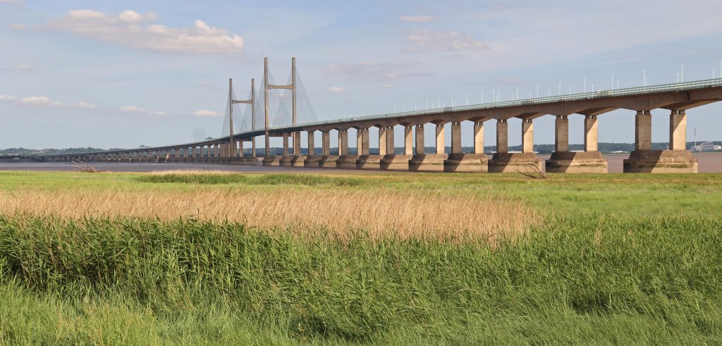
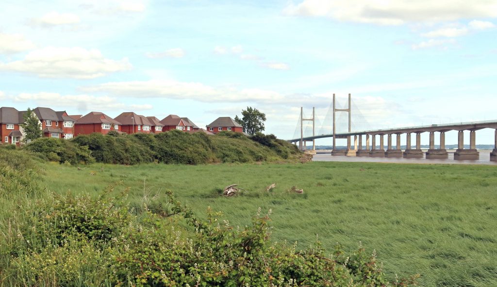
Across the marshes looking towards the Prince of Wales Bridge
Introduction
Another sweltering day was on the cards for my monthly estuary walk. Still, I figured that by doing the ‘mirror image’ of my last route — from Aust to Severn Beach — but this time on the other side of the Severn, between the two bridges, we might at least find a bit of shade beneath the structures themselves.
Keen to build on the stories we’d uncovered during that previous walk, I set out with Geoff, my trusted companion and husband, to explore the Severn shoreline between Beachley and Sudbrook. Much of our route followed the Wales Coast Path, winding through landscapes so well documented by the Living Levels project.
I hope you enjoy reading about our day out as much as I enjoyed walking and researching it — preferably with a cool glass of something refreshing in hand. (There may even be a few ideas for that later…)
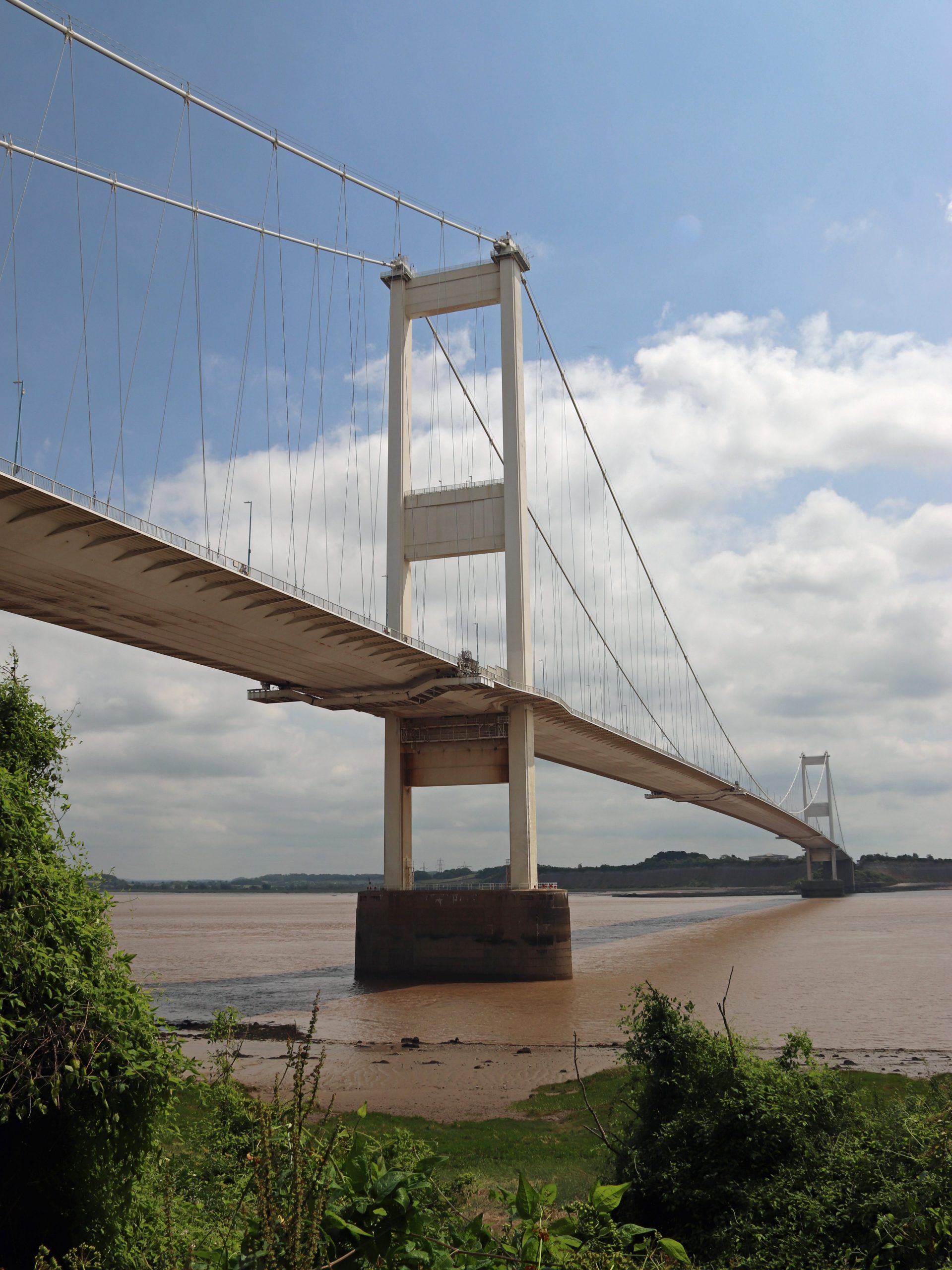
The Severn Bridge from near Beachley Point
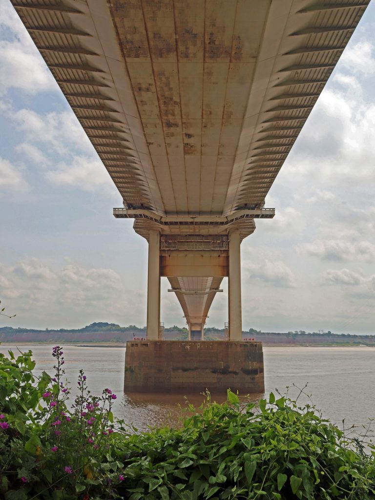
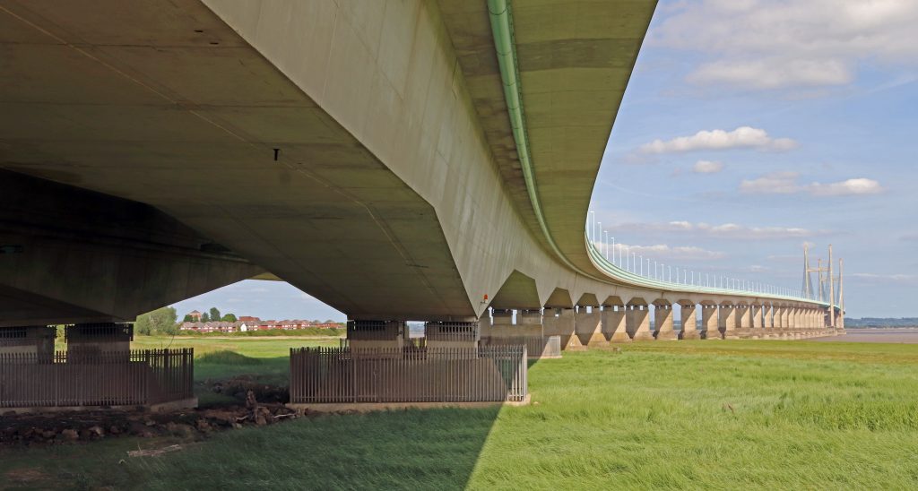
Underneath the arches: the Severn Bridge undercarriage
The river crossings – the Beachley Slipway and the Severn Bridge
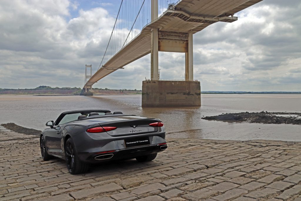
My attempt at a ‘commercial’ photo shoot!
Beachley – the old and the new crossings
Parking in the shadow of the Severn Bridge alongside a tangle of undergrowth, a ‘Danger: sea wall unsafe – keep away’ wasn’t quite the welcome I’d expected. The Old Ferry Inn which I remember seeing during a photo shoot twenty plus years ago seemed also to have lost its charm despite efforts to renovate part of the building as a conference centre. The Severn Area Rescue Association (SARA) station next door was eerily quiet too, despite various noticeboards highlighting the incredible work that operates out of this otherwise unremarkable building.
Then, we turned to look at what we had come to see — the Beachley to Aust crossing, the other end of the Old Passage that we’d encountered on our last walk. The wide stone ramp of the old slipway sloped gently downward, as if inviting us to step into the chocolate-brown waters of the Severn. No ferry today, though – the last car ferry crossed the estuary here nearly sixty years ago, on the day before the Severn Bridge opened. However, many older people still have happy memories of travelling on this ferry. Kay Powell, a former SEP Chair, excitedly recalled her childhood experiences. In our recent get-together she recounted her summer outing from Cardiff to visit her great aunt in Portishead. ‘The most exciting thing was when my dad got a car, and we’d go via the Aust Ferry. There we could see the sea gently receding. And there we were, counting the numbers of cars back, seeing if we’d get on the next ferry. And actually getting onto that with the turntable and going across to Aust…an amazing experience!’ Kay is one of many generations to have used this historic crossing — a route once travelled by Roman legions and 12th-century monks. As we watched the swirling muddy waters recede at the bottom of the slipway, it was easy to understand though why several fatal crossings had occurred here in the mid-nineteenth century — and why Daniel Defoe reportedly chose to avoid this crossing, opting to travel through Gloucester instead.
This crossing, however, is no backwater. It still serves as the slipway for SARA and other watercraft. During our visit, the slipway also served as a spot for a local angler to fish and a mooring for the fishing boat Helen Louise. Its owner eagerly shared stories of fishing for cod, conger eel and other fish in the Severn and fondly recounted crossing the old ferry as a boy, when he and other kids would hop on and off to catch a ride to the other side. “It hadn’t been the same once the bridge was built, but at least the pilots [many of whom were called Jack] were able to find work operating the toll booths,” he reflected. Later, as I focused on capturing better angles and shadows for my photos, I was distracted by the buzzing of a small drone overhead. Then, to my surprise, a sleek Bentley sports car smoothly glided onto the slipway. The slipway had become the unexpected backdrop for a commercial photo shoot! As you can see, I had a go at some glitzy photos, with moderate success.
Beachley Point – connections
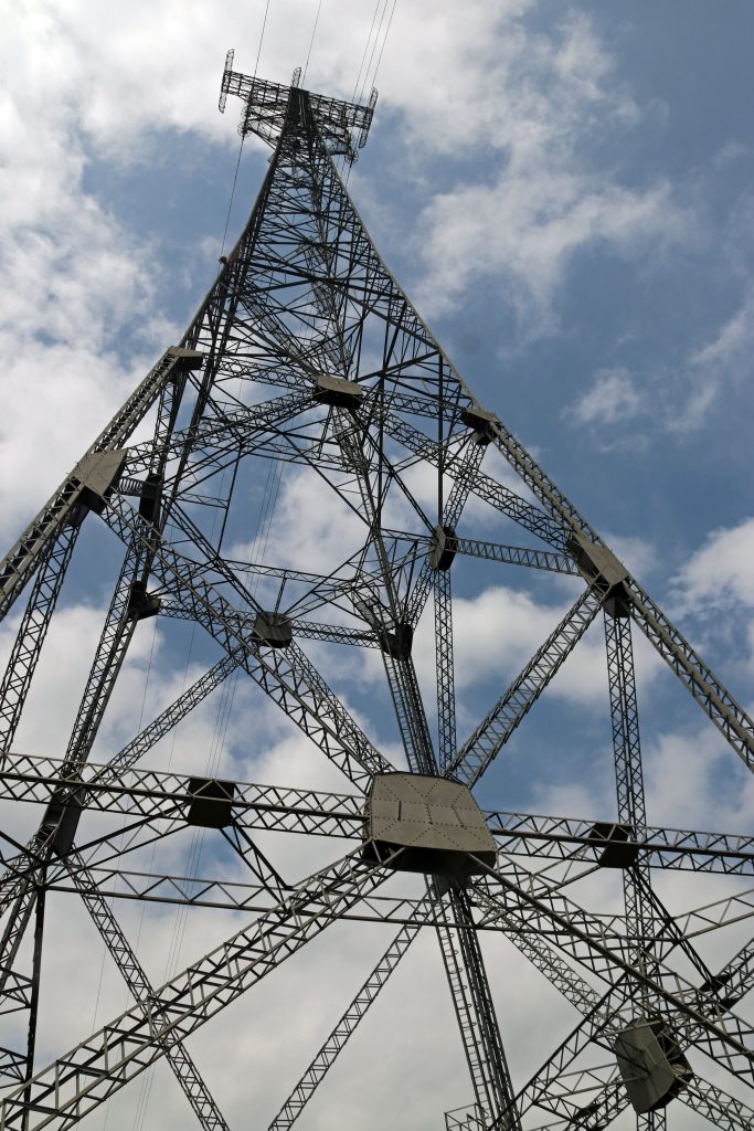
After a short stroll along a leafy track, with occasional glimpses back toward the Severn Bridge, we arrived at a rather scruffy spot near the National Grid’s Beachley Compound, overshadowed by the striking anchor pylon soaring an impressive 148 metres above. At just 10 metres shorter than Blackpool Tower and significantly taller than any of the ‘skyscrapers’ in the cities surrounding the estuary, this pylon — along with its twin at Aust —supports the longest overhead power line span in the UK, stretching an impressive 1,618 metres. We craned our necks to take in the sheer scale of this giant electrical bridge stretching across the Severn!
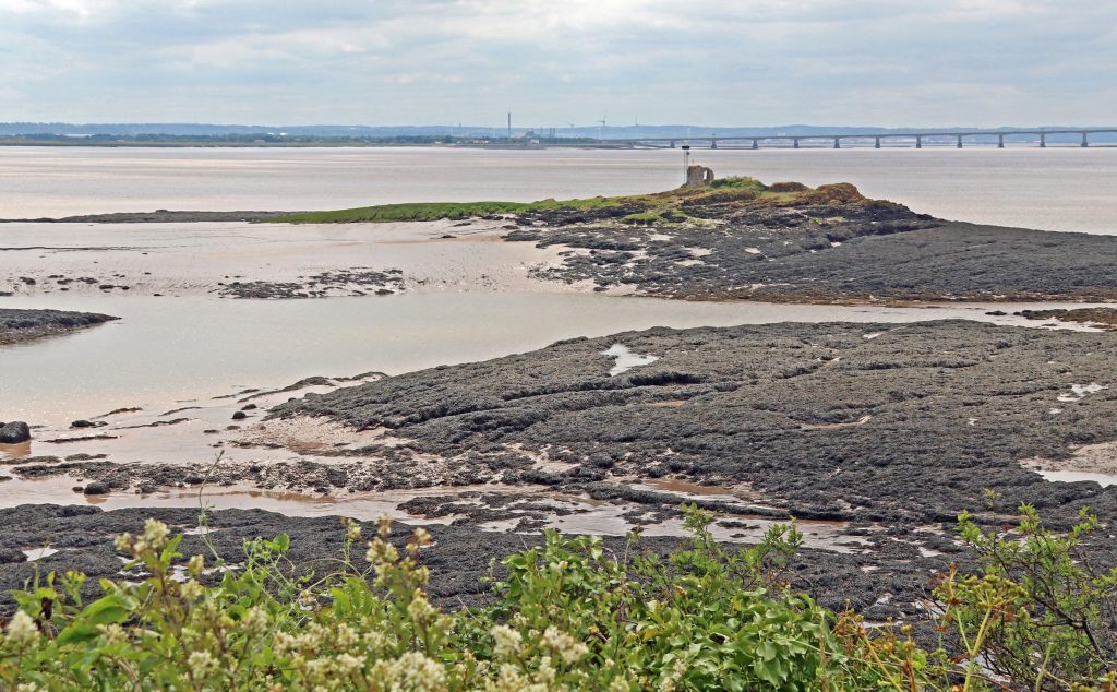
We hadn’t come to admire the pylon, however — spectacular as it was, but rather to take in the views of the estuary and catch a glimpse of ‘Tracey Island,’ which I first spotted during my sail on the Waverley last summer. After some careful negotiation, avoiding stinging nettles and brambles, we eventually made it to the viewpoint at Beachley Point. Beyond a carpet of brown seaweed and glistening, slippery mud, the faint silhouette of a ruin perched on a rocky hummock came into view—the island known by so many names – Chapel Rock, St Twrog’s Island, St Tecla’s Island…and now Tracey Island, of course! Despite the falling tide, there was no chance we’d attempt to reach the ancient ruins of this medieval holy site today, just as generations of pilgrims are said to have done in the fourteenth century. I could certainly understand why this site once served as a refuge for hermits. However, with so many modern intrusions visible across the mudflats — pylons, warehouses, and other stark reminders of the 21st century, it was difficult to imagine the solitude that once defined this place.

The impressive anchor pylon near Beachley Point
Across the seaweed towards the island of many names
View across the mudflats towards the Wye Estuary
Black Rock – tidal landscapes, lave fishing and estuary connections
After retracing our steps, we drove to Black Rock, where we enjoyed our picnic lunch accompanied by spectacular views of both bridges stretching across the estuary. The scene was made even more striking by the vast intertidal zones laid bare by the low tide. With the mudflats and seaweed-draped rocky reefs exposed, the foreshore revealed a captivating and ever-changing landscape, though a treacherous one, as signalled by the white lighthouse that stands guard over the offshore reef (Charston Rock) hidden beneath the water at high tide. Later, treading carefully, I explored the edge of the marsh and was fascinated by its intricate microtopography. Dense tufts of saltmarsh grass rose on small hummocks, criss-crossed by a network of hidden and shallow hollows, some still holding water. It was a remarkably complex and diverse ecological system — shaped by a long and layered history of both erosion and deposition. Even just inland from the true marsh edge, isolated stems and clumps of cord grass were beginning to take hold, pushing up through the drying cracks in the mud.
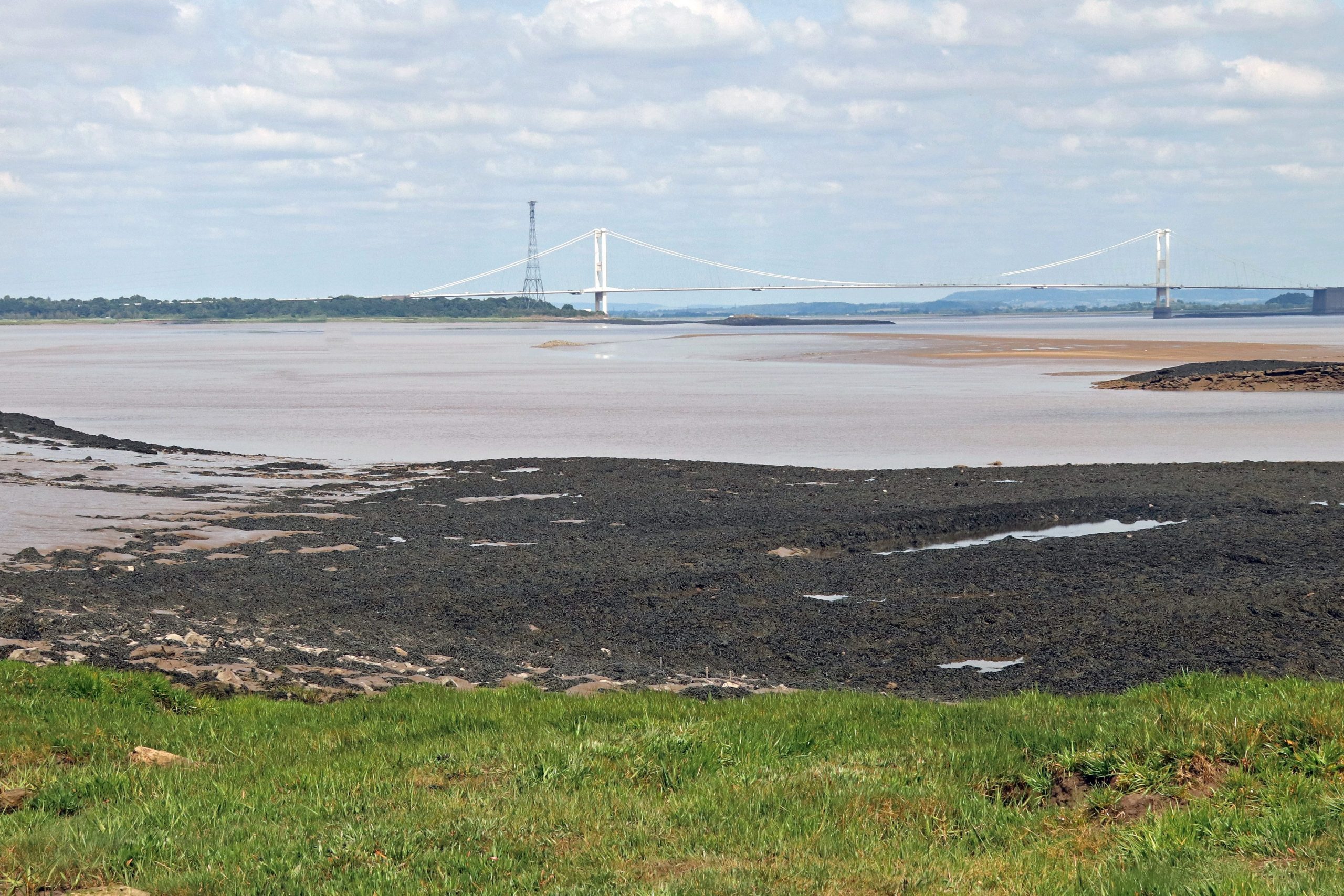
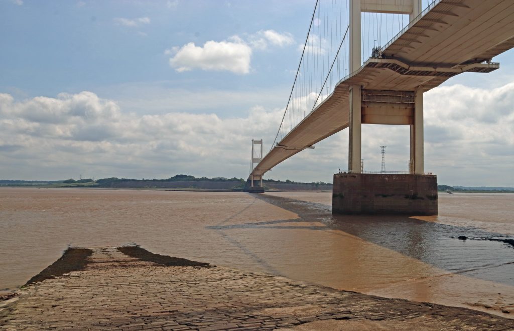
View upstream to the Severn Bridge from Black Rock
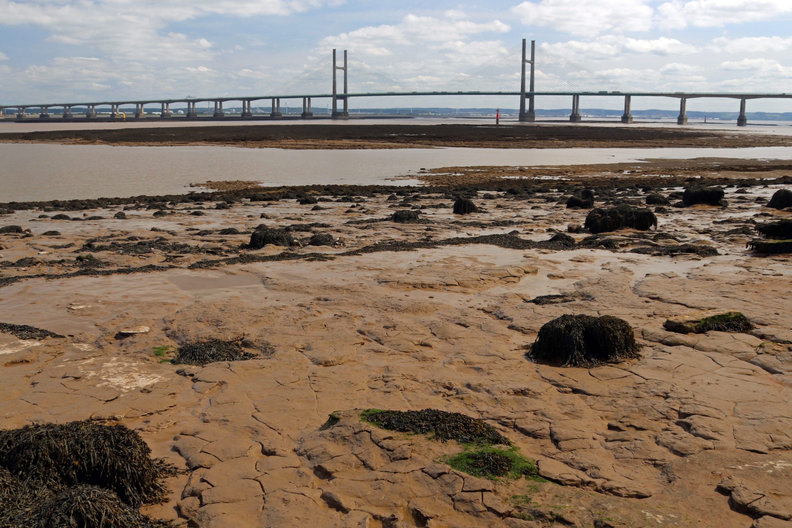
View downstream to the Prince of Wales Bridge
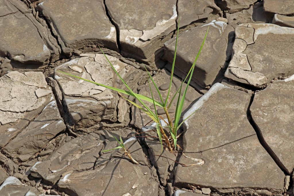
Cordgrass attempting to colonise the mudflats
Suddenly, we spotted one of the famous lave net fishermen striding across the mud, likely returning from the channel after a session of fishing. He carried his distinctive willow-framed net, just visible in the photo below. Although now a catch-and-release heritage fishery for salmon — somewhat contentiously — this centuries-old tradition is still upheld by a few dedicated local fishermen at this heritage site. According to their Facebook page, the group has built quite a following, and their videos are well worth exploring. You’ll find everything from explanations of how the nets work to footage of their fishing finds, including ancient fish traps, curious debris, most unwanted items, and more. If you’re interested in learning more, they’re hosting a special open day on 25 August. To celebrate this enduring tradition, there’s even a striking, larger-than-life oak sculpture of a fisherman and salmon, carved by local chainsaw artist Chris Wood, proudly displayed near the picnic site overlooking the estuary — a piece we stopped to admire.
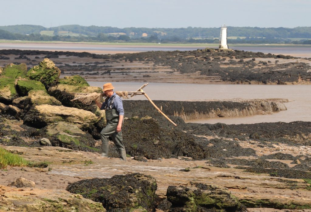
A lave net fisherman returning to shore with the Black Rock lighthouse in the background
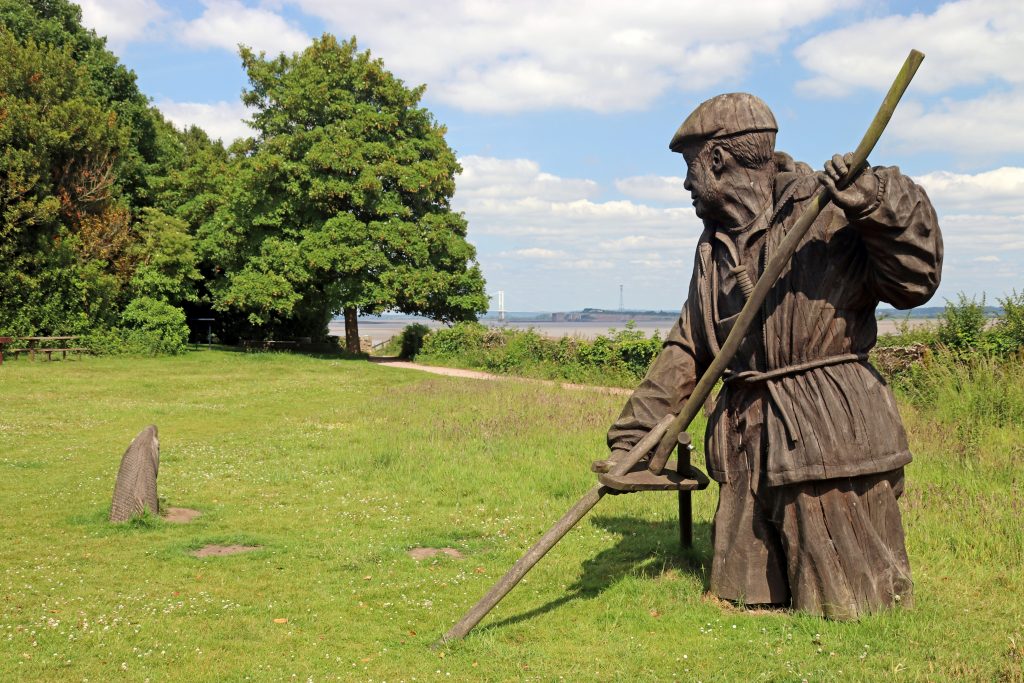
The Fisherman sculpture at Black Rock picnic site
Nearby, facing out to sea, another sculpture from the People and the Landscape series caught our eye — standing proudly atop the remaining stump where the rail-steam ferry once crossed to New Passage, which we’d visited just a month earlier. The Engineer — a distinguished figure in a smart coat, hat, and walking stick, holding a model of a factory in his left hand. This sculpture pays tribute to all those who worked on the Severn Tunnel, the two bridges, and the seawall that protects the Gwent Levels. It’s inspired by the intrepid and resilient 19th-century engineer Thomas A. Walker, who completed the Severn Tunnel and oversaw the development of the neighbouring village of Sudbrook — where we were to head off to next.
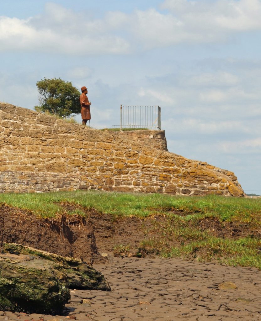
The Engineer sculpture standing proud above the old Black Rock slipway
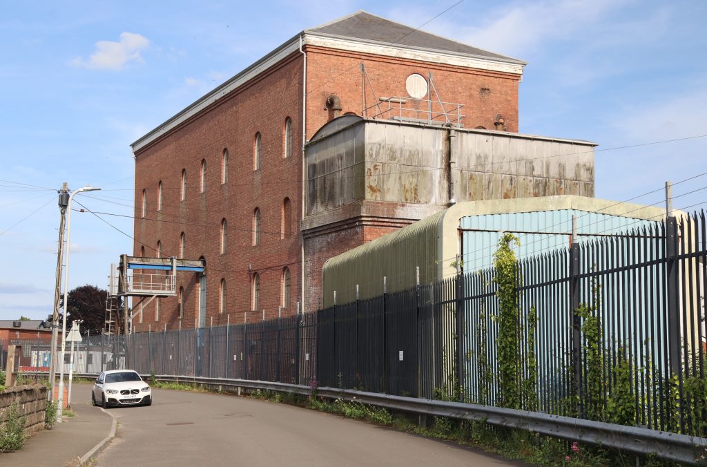
The imposing Victorian Sudbrook Pumping Station
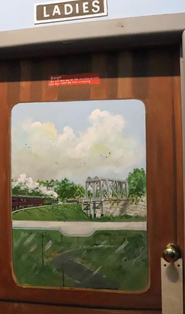
The view on the door of the Ladies toilets

Sudbrook – discovering more Severn heritage
The shade along the leafy path gave us some much-needed relief as the temperature climbed, and it was with a certain relief that we reached the edge of Sudbrook. After passing some nondescript modern developments, we found ourselves on a long street lined with cottages — part of Walker’s workers’ village from the nineteenth century, built during the construction of the Severn Tunnel. With their colourful façades and flower-filled gardens, it was striking to think these homes had once been humble dwellings for the labourers working on this ambitious project – one we still rely on today, as trains whisk us through the Severn Tunnel in under four minutes on our journey to and from South Wales. As we approached the imposing red-brick Sudbrook Pumping Station rising high above the cottages at the heart of the village, we could hear the steady whirring of machinery. No fewer than fourteen pumps are required to keep 50 million litres of water out of the tunnel every day, and, as Network Rail informs us, these must be replaced every three decades. As we learnt later from our visit to the local museum, confronting and containing the ‘Great Spring’ was one of the great engineering feats of the late nineteenth century.
The Sudbrook Interpretation Centre is quite a gem and is worth a visit, although tucked away in the corner of the Sudbrook Non-Political Club, it wasn’t that easy to find. Though we seemed to enter through a back door, we were immediately transported into another world — greeted by colourful murals in the entrance hall celebrating railway triumphs and journeys. Even the toilet door was painted, as you can see below.
The exhibition room, though modest in size, held a fascinating and eclectic mix of local stories and memorabilia that we eagerly explored. Alongside informative display boards lining the walls were towering stacks of scrapbooks, school projects, and old photo albums. Glass cabinets showcased an array of finds from the mud of the River Severn—many with real historical significance. There was even the horn of a medieval cow and a whale bone from a whale that washed up at Sudbrook a century ago, in 1925!
We took our time delving into the material — not only was it genuinely fascinating, but it also offered a welcome cooling refuge from the sweltering heat. I have to personally thank the Caldicot and District Historical Society, not just for curating such an engaging collection, but also for the thoughtful touches like the tea and coffee-making facilities. If only every community around the Severn Estuary had such a valuable and lovingly maintained resource.
The Prince of Wales Bridge – yet another perspective!
After enjoying the cool respite of the museum, we stepped back into the searing afternoon heat to complete our bridge-to-bridge journey — determined to reach the Prince of Wales Bridge on the Welsh side of the estuary by foot. Skirting behind more of the original workers’ cottages, we eventually found ourselves crossing a football pitch by the water’s edge. But this was no ordinary pitch — it stands within Sudbrook Camp, an ancient hill fort likely dating back to the Iron Age. Over the past two thousand years or so, significant coastal erosion has claimed much of the southern ramparts, now lost to the sea. Perhaps something the residents of the extensive new housing estate to the west of the village — partly nestled within the remaining ramparts — should be mindful of, especially given the size of some of the debris scattered along the strand line on the marshes.
With the sun beating down, I must admit I struggled to walk the rest of the path, which, being wide open to the coastal marsh, offered no shade. The ever-changing marshes and sweeping coastal views kept me going, though I found myself increasingly distracted by the roar of traffic growing louder and more thunderous as we neared the bridge. After nearly emptying our water bottles, we finally reached our destination — and the cool shade beneath the bridge’s undercarriage was a truly welcome relief.
Amid the relentless noise of traffic, focusing on taking meaningful photos was a challenge, but I hope the ones that follow convey the sheer scale of this mighty structure from our vantage point — a strikingly different perspective from what we’d seen on the other side of the estuary only a month ago. Here at Caldicot, the bridge twists sinuously across the marshes, stretching into the distance like a giant centipede resting on towering pillars. We savoured our final glimpses through the arches, offering an intriguing view of this impressive feat of engineering, before making our way back to Black Rock — via the wonderful refuge of the Sudbrook Interpretation Centre, of course.
Housing nestling behind Sudbury Camp – note the storm debris on the marsh
The Prince of Wales bridge meandering above the marshes at Sudbrook

Further reflections and conclusions
Whether it’s an unexpected perspective on a familiar place or a fresh angle on a well-known structure, there’s always an element of surprise that keeps us engaged as we explore each stretch of this remarkable estuary — and this walk was no exception. It was far from a mirror image of my previous walk, though there were many similarities and parallels — not least the sweltering heat on both occasions. But new stories had emerged on this side: tales of the traditional lave net fishery, for instance, and the unexpected popularity of the old Beachley slipway as a photo shoot location.
The strategic importance of river crossings — and their influence on the ups and downs of coastal communities — is something both stretches of the estuary share. Sudbrook, for one, quite literally owes its existence to the construction of the Severn Tunnel. Today, it’s a far cry from Walker’s original ‘new town’ plans, but one thing hasn’t changed: the Great Spring still needs taming. Indeed, next time you crack open a Budweiser, Stella, or a pint of Welsh bitter, there’s a chance you’re actually drinking water from that very spring — it now supplies the local brewery at Magor! As for me, after a scorching day out, I gave the beer a miss and opted for a tall glass of my trusty Severn Beach/Pilning cordial, the perfect way to reflect on yet another memorable day by the estuary.
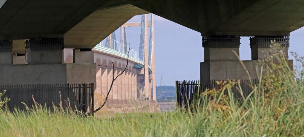
An intriguing perspective through the arches of the Prince of Wales Bridge
Further information
Check out this link for a stunning photo of a bridge section being installed over the ferry slipway at Beachley
Living Levels Loop and Links Walk 5 – Caldicot to Black Rock loop
Sudbrook and Portskewett trails through the ages