And the Point is – exploring Sand Point and Brean Down
And the Point is – exploring Sand Point and Brean Down
Rhoda visits two of our longest natural piers extending into the estuary, discovering their past role in strategic defence and their present-day value as open spaces for nature and wellbeing.
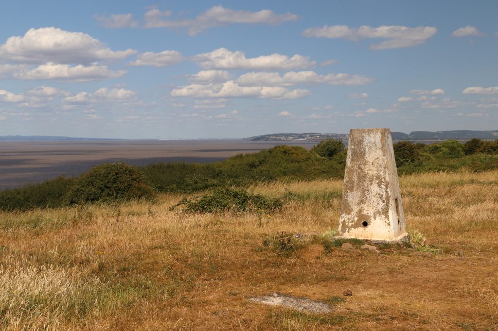
Looking towards Weston-Super-Mare with Sand Point in the mid-distance from Brean Down
Introduction
Sand Point and Brean Down – two of my favourite spots on the estuary – and a great chance to visit both alongside our annual forum in Weston-super-Mare! With no students to oversee, no tricky fieldwork to organise, and no grumpy coach drivers to deal with, Geoff and I set out to rediscover the charm of these places in relative peace – and in surprisingly good weather, too. Armed with a wealth of insights from the forum, and thoughtful perspectives from Annemieke Waite, the North Somerset Councillor who’d opened the event, I hope you enjoy reading about our half-day adventures – and maybe feel inspired to explore them for yourself sometime soon.
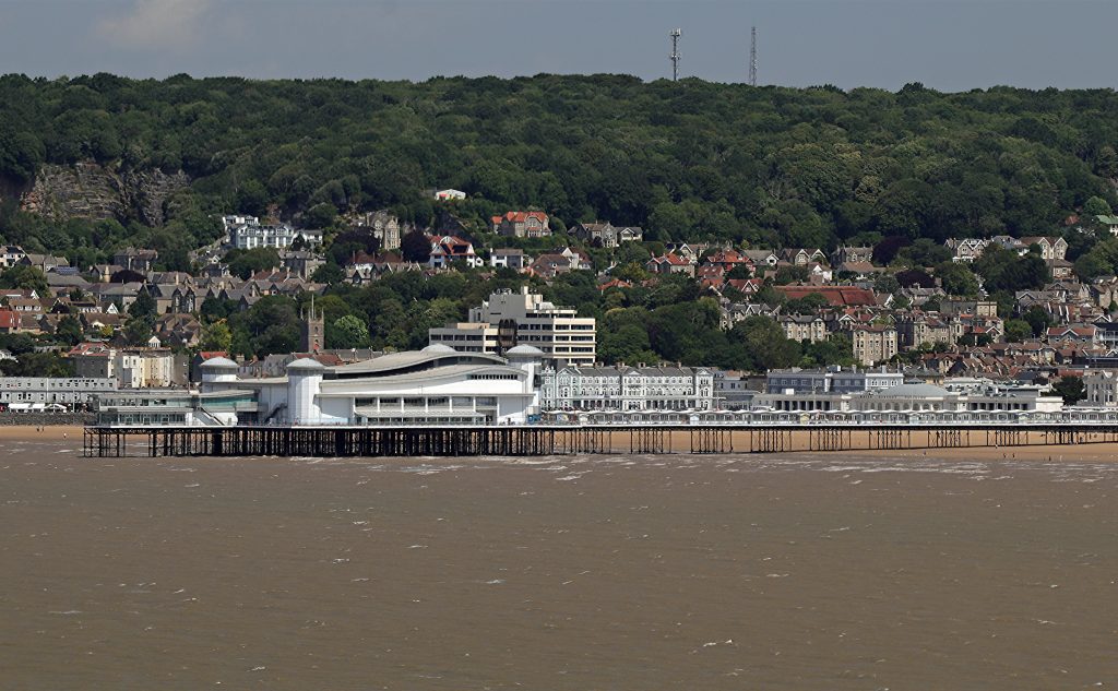
Weston’s Grand Pier from Brean Down
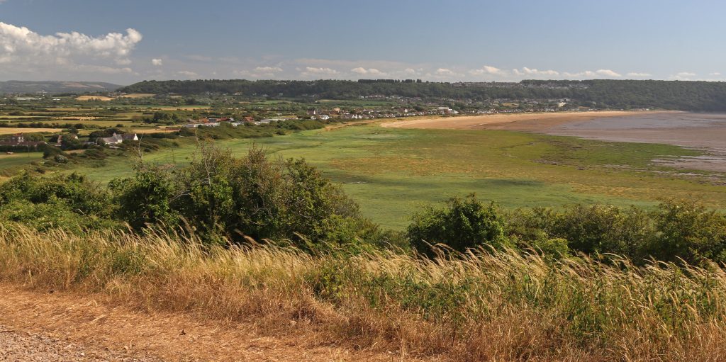
Excursion one – Sand Point
Driving along Beach Road in Sand Bay, with the sea largely obscured by vegetated dunes and hedgerows, gave little hint of the landscape beyond. But after a short climb through woodland, we emerged onto the broad grassy ridge of Sand Point, and were rewarded with sweeping views across and up the estuary. What a panorama! Clevedon, Newport, Brean Down, the islands (including Denny Island, of course), the bridges and even The Garth —the hill just behind our home in North Cardiff—were all clearly visible. No wonder this spot held such strategic importance for past generations—even, it seems, as far back as the late Neolithic or Bronze Age. As I watched white, fluffy cumulus clouds scuttle across the sky, casting flickering shadows over the reddy-brown, turbid waters of the estuary, I found myself wondering how the scene might have changed over time. While the settlements, industrial sites, and other human landmarks are relatively recent and the extent of the estuary’s waters may have migrated over time, the low-lying, gently sloping dark silhouettes of the hills framing the estuary have stood here for millennia.
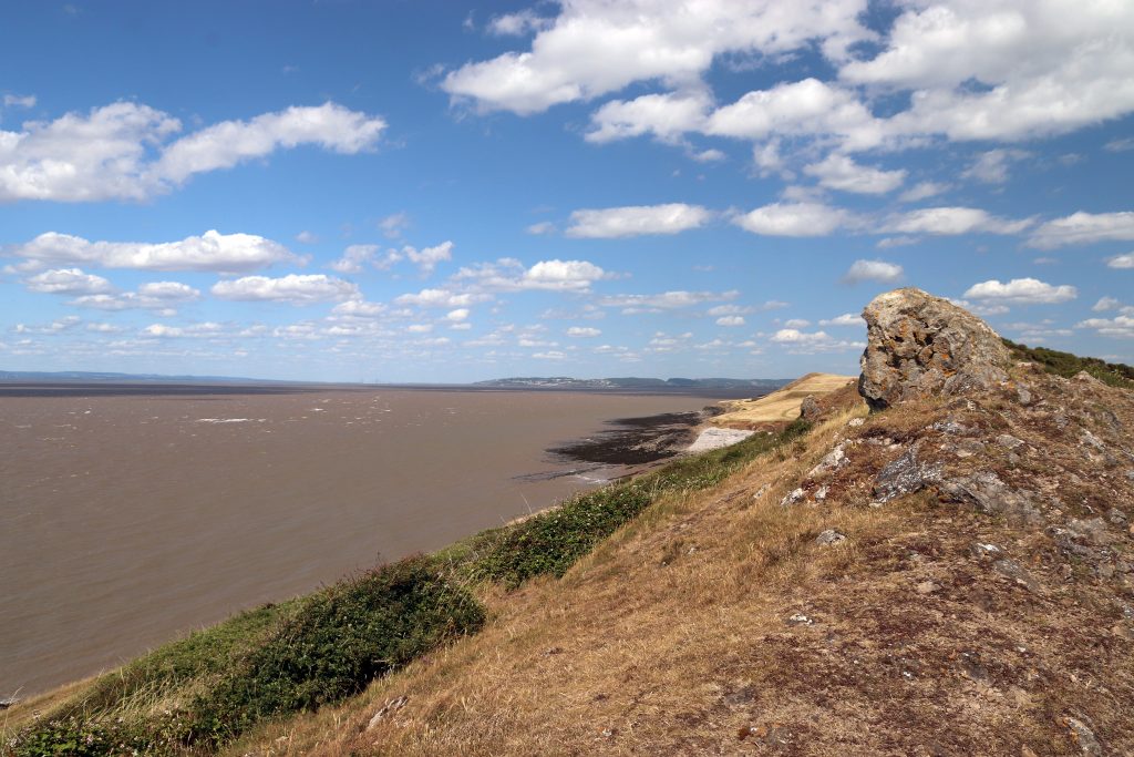
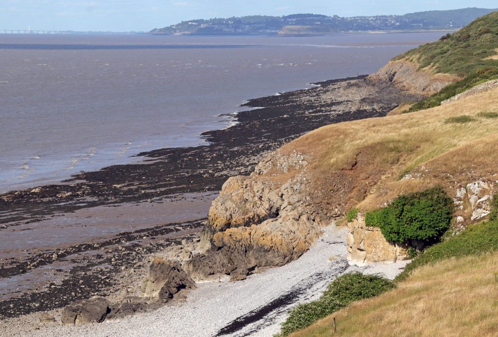
As we walked further towards the Point, the views became even more spectacular. On our stroll, knolls of weathered limestone rose sharply above us, their jagged forms resembling the worn teeth of some long-extinct creature emerging from the estuary’s mud. The rising bluster of the wind lent an uncanny sense of movement to the landscape. In reality, these jagged crags of Carboniferous Limestone are the remnants of a shallow tropical sea, formed when this part of the world lay near the equator. Like many sites around the estuary, the limestone here is rich in fossils, containing the remains of corals, crinoids (sea lilies), and other long-extinct marine life. These limestones are also distinctive because they’re more resistant to erosion than many other rocks around the estuary. As a result, they tend to form the tips of most of our headlands and islands —something I always enjoyed pointing out to student groups over the years.
Further along the path towards the Point, increasingly craggy limestone outcrops began to intersect, and eventually merge with, our path. With the wind picking up, walking became increasingly difficult, so, I decided to stay put and take in the panoramas and search for fossils. Whilst the fossil hunt proved fruitless, I did enjoy the sweeping views out to the Holms and the silvery sheen of the calm waters beyond. As the tide receded across Sand Bay, I noticed the deep, meandering channels etched into the mud as they wound their way to the sea—and found myself reflecting on the ever-changing nature of such features. Yes, once a Physical Geographer, always one!
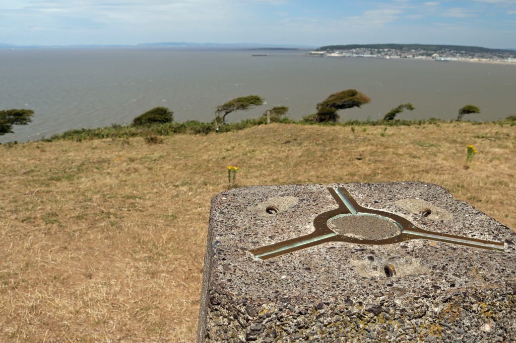
Sand Point Trig. Point overlying a late Neolithic/Bronze age site
View up the estuary from the rocky outcrops on Sand Point
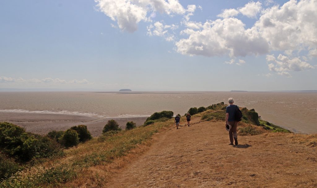
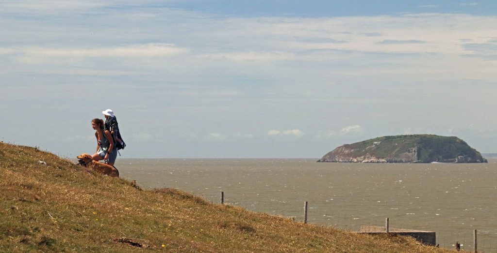
Walkers at Sand Point with distant views of the Holms
Meanders across the extensive mudflats of Sand Bay
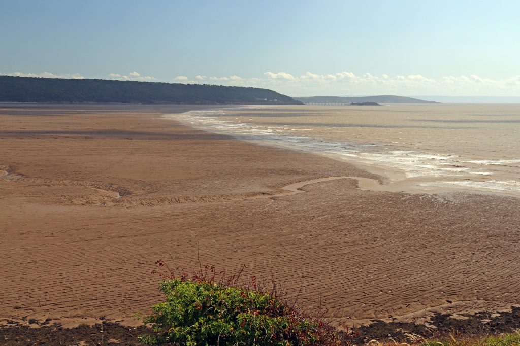
The broad pebble beach at Middle Hope – July 2025
A much greener landscape around Middle Hope, Summer 2021
Looking down on the green beach towards Kewstoke with the ‘sand’

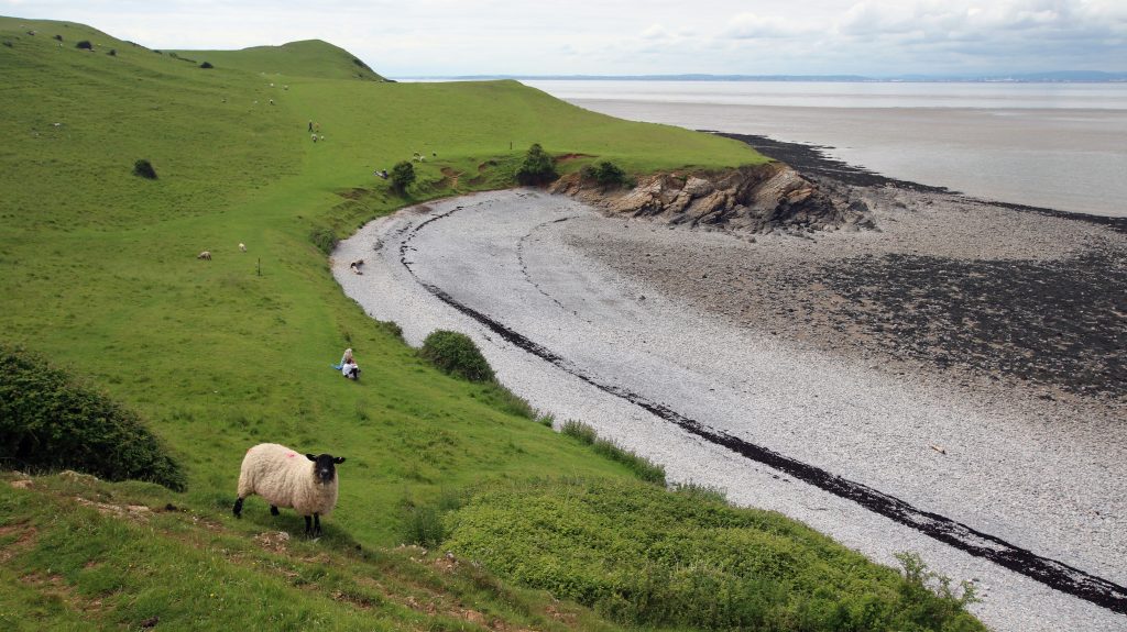
With time on our hands— no students to herd or coach to rush back for —we walked over to Middle Hope; an extra bonus. This delightful, unspoilt pebble cove never disappoints. Today, though, the scorched golden grassland on the surrounding cliffs stood in stark contrast to earlier visits, when the cliff tops were covered in lush, velvety green. No carpets of golden buttercups, but a few resilient wildflowers, including bright stands of ragwort, popping out from amongst the dried grasses. Sorry, I’ve no photos of these – they were swaying too wildly in the breeze!
We didn’t explore the beach’s geology on this occasion, but standing on the cliff top I was reminded of the excitement of past student visits, when we’d searched for volcanic rocks here. Yes—volcanic rocks on our estuary! This cove hosts a fascinating range of rocks, including pillow lavas—pillow-shaped rocks formed by submarine volcanic activity, much like the eruptions still occurring off Hawaii today. It’s no surprise this site is protected as a Regionally Important Geological Site (RIGS) for its exceptional geological value.
It’s a particularly special place for Annemieke too, who shared one of her most cherished family memories from a cold blustery day last winter. The day was especially meaningful as her ‘extended family spans all ages and is geographically quite spread out’, so ‘it was wonderful to reconnect with loved ones we don’t often get to see.’ After walking all the way out to the Point, they’d enjoyed ‘thermos flasks of hot chocolate’ as they ‘sat on the rocky beach sipping warm drinks while the children searched for seaweed and collected pebbles.’ Returning to the car park ‘with heavier pockets, they’d got back ‘just in time for hot dogs being cooked up by one of our family members.’ I can almost smell those sizzling sausages!
As we made our way back to Sand Bay, we looked out over the wide expanse of green saltmarsh below and couldn’t help but question the name Sand Point—surely a bit of a misnomer! But as the photo shows (and as I’ve seen on previous visits), there really is sand at the southern end of the bay. This is here partially thanks to a major beach nourishment scheme in 1983–84, following the infamous 1981 storm that caused severe damage along much of the low-lying Somerset coast. This was one of the first large-scale projects of its kind in Britain: over 600,000 tonnes of sand were dredged from the Severn Estuary and pumped onto the beach, raising it by around three metres at the sea wall (Source). There’s also been more recent work at Uphill which Annemieke was keen to point out. Here fencing has been installed in front of the sand dunes to help strengthen and stabilise them. She hopes this will not only improve flood protection but also enhance the biodiversity and ecological quality of this important natural habitat—one that has, sadly, been significantly eroded around the Bristol Channel and Severn Estuary.
Excursion two – Brean Down
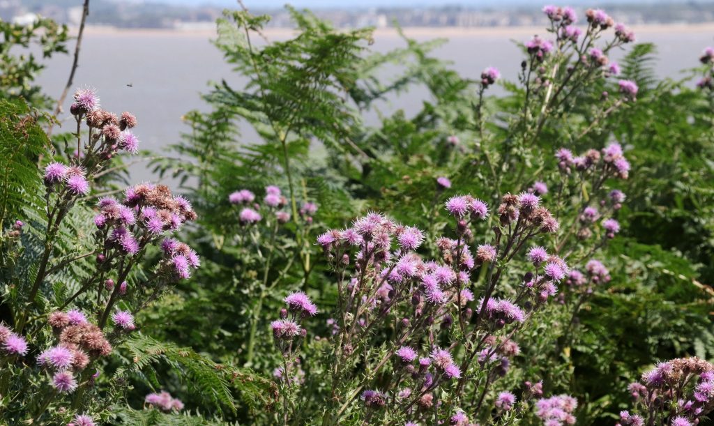
After a day of talks and discussion at the Severn Estuary Forum—held, fittingly, on Weston’s Grand Pier, seemingly floating above the tidal muds of Weston Bay—it was a real pleasure to get outside to experience the estuary firsthand again. However, from the outset, it was clear this would have been a very different outing from Sand Point. The sheer number of parked cars and people milling about on the beach set quite a different tone. I’d also forgotten just how large Brean Down is—but was quickly reminded as we began the steep climb up the long flight of over two hundred steps to reach the top of the limestone grassland ridge. I made it to the top, with a few welcome pauses to admire the beautiful wildflower displays edging the path. Thistles, mallows, and scabious swayed gently in the breeze among the brilliant white limestone rocks, their pinks and mauves blending like a natural wildflower garden. Thankfully too, the ever-expanding views over Brean Sands and the sweep of the Bristol Channel provided ample encouragement to keep going.
One of the many colourful floral displays along our route
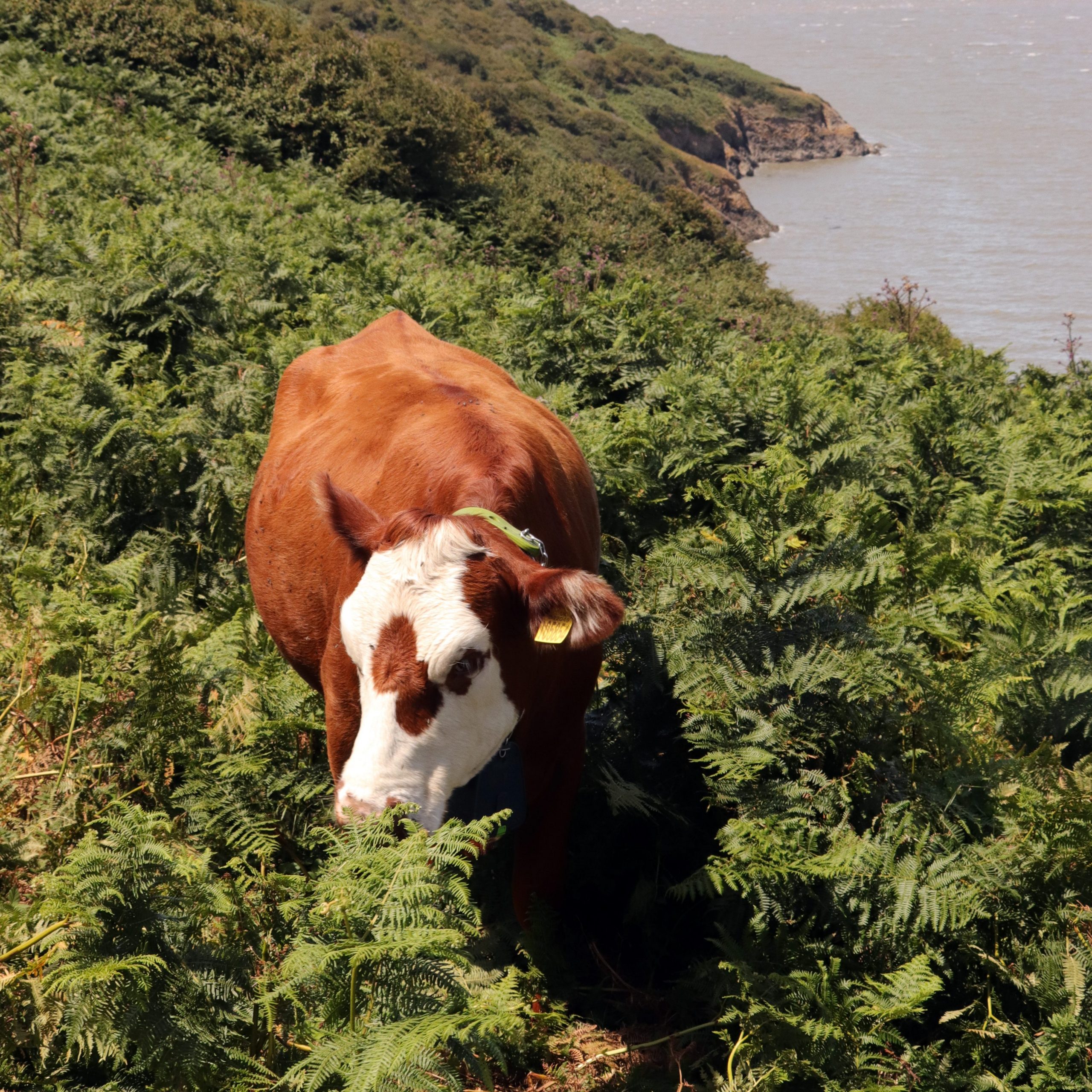
We crossed to the northern side of the ridge and followed the old military road that leads to Brean Down Fort. As we admired the sweeping views over Weston Bay—its piers stretching out below and Sand Point visible in the distance—a herd of brown and white cattle suddenly emerged out of the bracken. With their large collars, they looked almost alpine—as if fitted with cowbells. But these were, in fact, solar-powered GPS collars, part of an innovative virtual grazing system designed to contain cattle within designated areas and facilitate conservation grazing. As the animals near the boundaries, they hear an audio signal; if they continue, a mild electric pulse gently deters them. This relatively new technology allows the National Trust to manage grazing across the Down more precisely, mimicking the patterns of traditional free-roaming herds. It supports the health of the limestone grassland by promoting biodiversity through targeted grazing. The same ‘NoFence’ system is also in use at nearby Crook Peak, where it’s helped monitor animal welfare too and with GPS ‘heat maps’ here, the Trust has also learnt more about how the cattle behave and move in different weather conditions. Quite remarkable!
An eco-cow grazing on the bracken northern slopes of Brean Down
The strategic significance of Brean Down’s headland was unmistakable as we approached the imposing ruins of Brean Down Fort—still formidable, even in bright sunshine. This was one of a series of Palmerston forts built along the English coast, including five in the Inner Bristol Channel, commissioned by Lord Palmerston (Prime Minister from 1859 to 1865) in response to the perceived threat of a French invasion. In the heat of the midday sun, we were glad to find some shade as we explored the ruins and studied the many informative exhibition boards dotted around the site. These offered a glimpse into the rather bleak living conditions once endured here, as well as its impressive Victorian military technology. In the end, Brean Fort never saw action and was widely regarded as an expensive folly. However, the site was later reused during the Second World War as a coastal artillery battery and a test location for experimental weapons—including, remarkably, trials of a bouncing bomb.
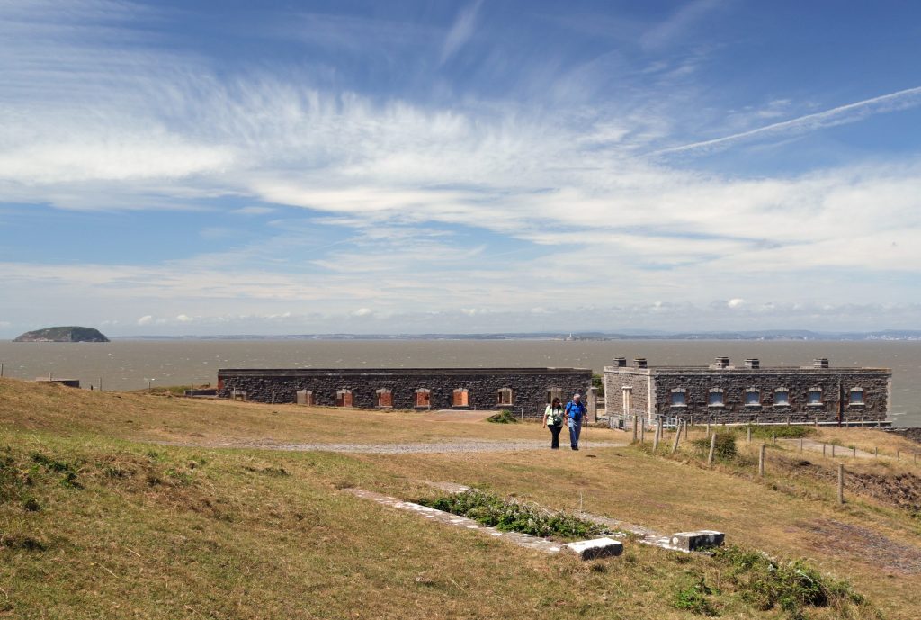
The Palmerston Fort at the tip of Brean Down
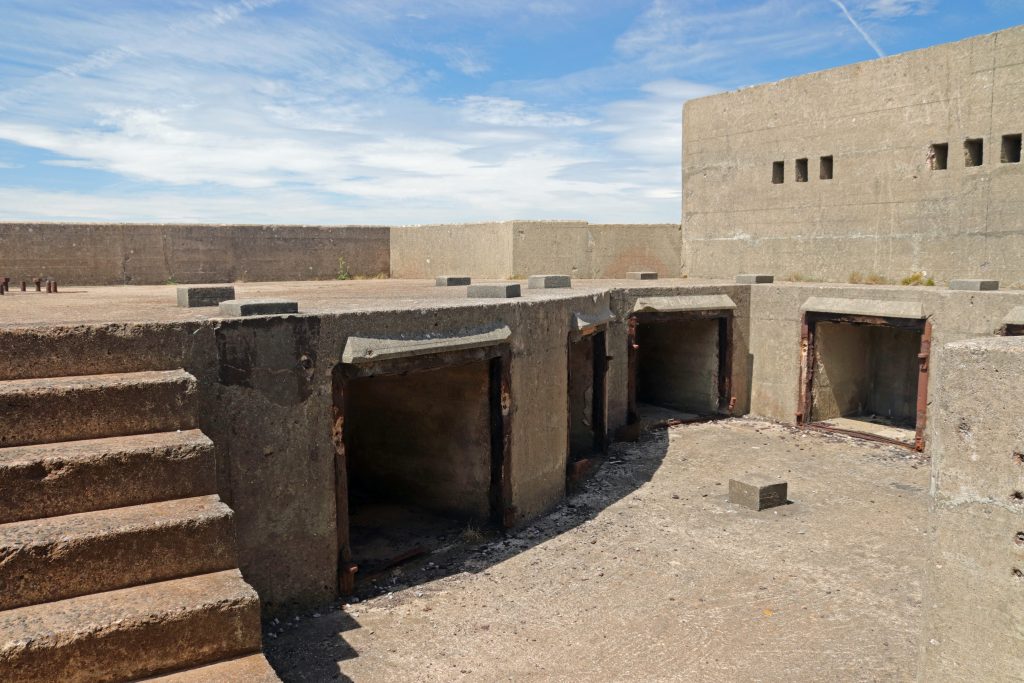
One of several formidable gun emplacements within the fort’s remains
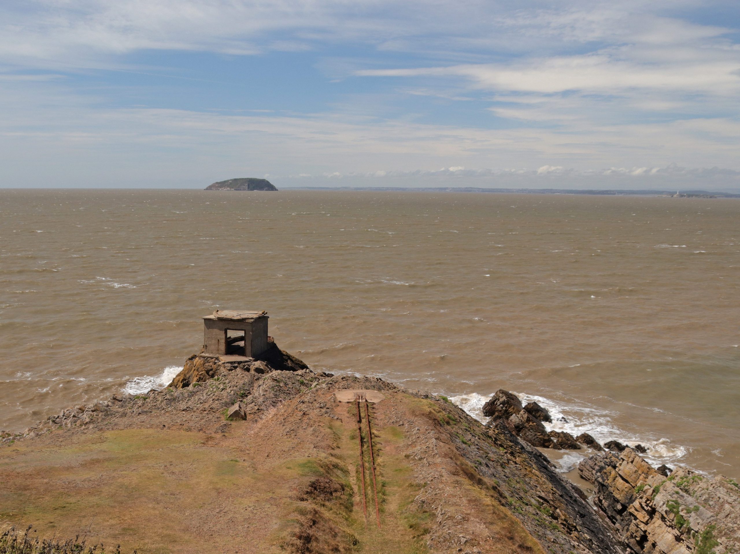
The Point at Brean Down – a Second World War launching rail for testing seaborne weapons and a searchlight for looking northwest
Enjoying sea views at Brean Down
Happy memories of a Marine Geography field trip in the summer of 2021 at the end of COVID!
After climbing up onto the Down in the glare of the summer sun, past strangely photogenic WWII lookouts and decaying fortifications, we paused to take in the majesty of the Channel and I reflected on earlier visits with SEP colleagues and student groups. All happy memories, and all, it seems, on similarly sunny summer days. I’m not sure if bigger is better when comparing Brean Down to Sand Point, but on such a clear, fine day, the views from Brean’s summit were undeniably spectacular. We could still make out the Severn bridges far in the distance, but now Steep Holm appeared much closer, framed by the distant South Wales coastline. To the south, the wide arc of Bridgwater Bay unfolded, and the Somerset Levels stretched seemingly forever before us—punctuated only by the ‘islands’ of limestone hills like Brent Knoll, not surprisingly another site of ancient human settlement.
As we made our way back along the hump-backed ridge, scorched grasslands underfoot, it was hard to imagine ancient communities living on this exposed promontory. Even today, wildflowers swayed vigorously in the coastal breeze and gnarled, wind-blown trees—more like ‘bad hairdos’ than natural features—offered a clear reminder that this exposed headland suffers the full force of the prevailing southwesterlies. And yet, just like at Sand Point, a number of finds from Bronze Age and Roman settlements dotted around the headland suggest people have lived here for millennia with. Indeed, we later discovered when looking at the National Trust’s map, we’d walked across an ancient field system and close to a Roman temple!
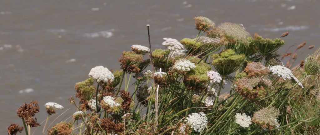
Umbels wafting in the strong coastal breeze
As we made our way along the ridge, striking limestone crags on the headland’s steeper southern slopes served as a reminder of Brean Down’s shared geological heritage with its northern sister, Sand Point. There was no chance of fossil hunting here, though—not with those sheer drops to Brean Beach! No intricate sand art to admire, as there’d been on previous visits either, but the views were still quite absorbing. From our lofty, almost toy-town vantage point, we could spot sunbathers tucked behind windbreaks, beach games in full swing, and even an ice cream van parked directly on the sand. Just beyond the line of riprap, where once there’d presumably once natural dunes, rows upon rows of static caravans and chalets stretched out, a clear reminder of Brean’s long-standing role as a holiday destination. Indeed, Fred Pontin had clearly seen the site’s potential when he opened his very first Pontinsholiday camp here in 1946, repurposing a former WWII US Army base. Today, even with the temporary EDF take over of the Pontins site as it’s used to house 900 Hinkley Point workers, Brean still ranks as the UK’s second largest camping and caravan resort, a fact that became instantly apparent as we returned to the hustle and bustle of the car park at the bottom of the steps, at the end of our excursion.
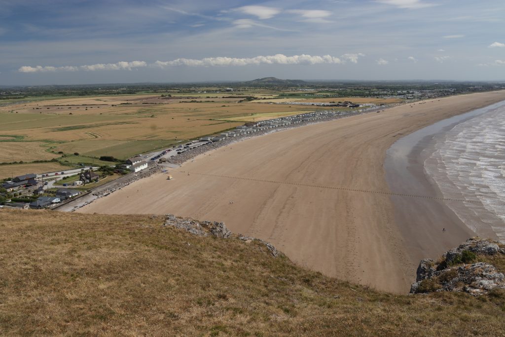
Looking along kilometres of Brean beach and the Somerset Levels from the ridge
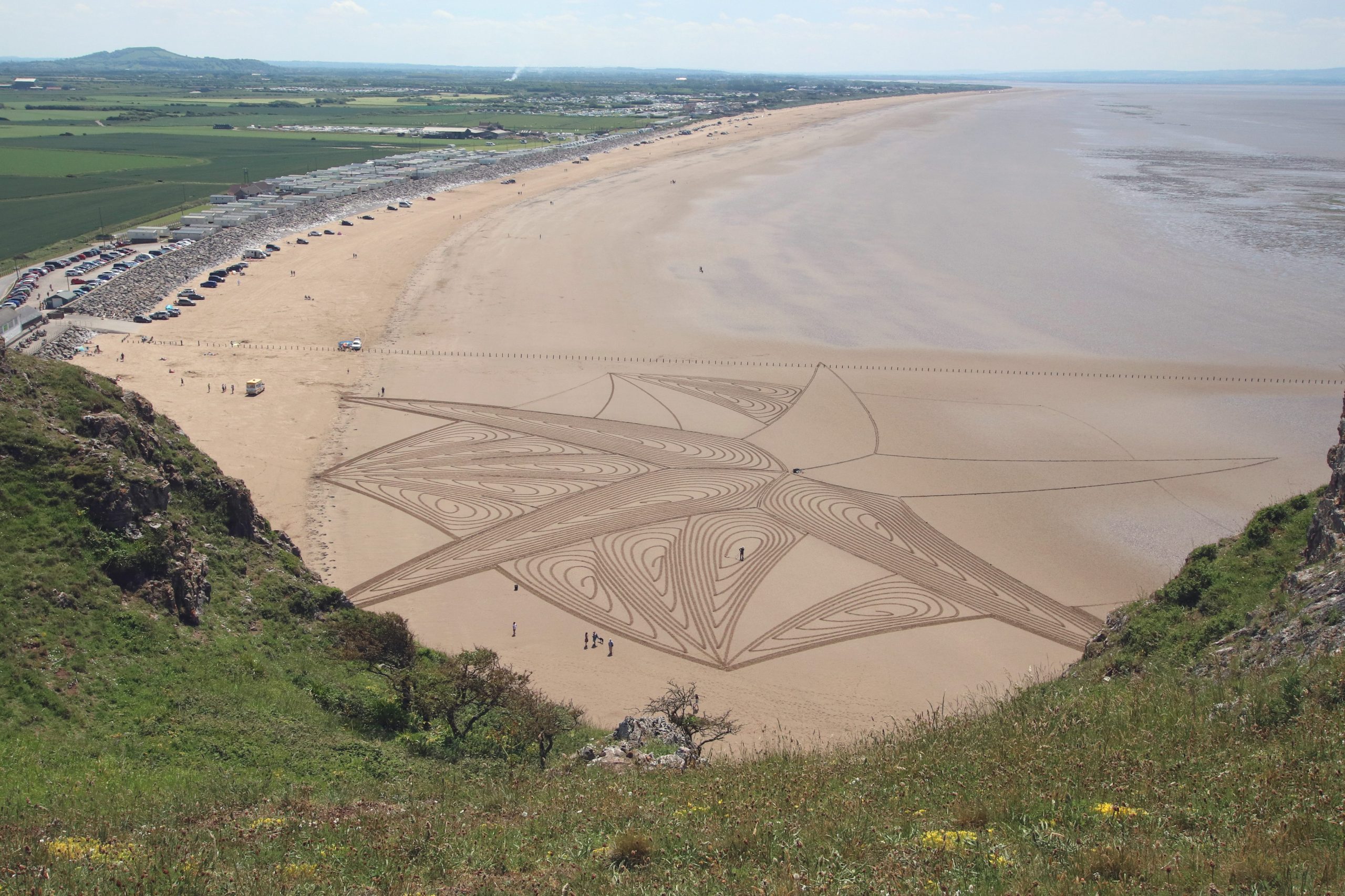
Brean beach art in progress, Summer 2021
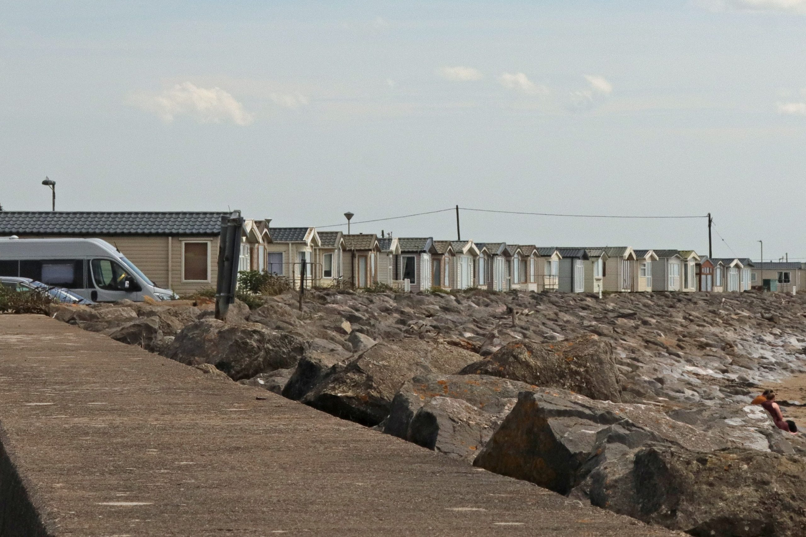
Back at beach level at Brean – quite a contrast to the peace of the Down!
Further reflections and conclusions
It’d been such a pleasure to revisit Sand Point and Brean Down after quite a few years—especially as they’re such familiar landmarks to us, often seen from our regular Welsh vantage points in Penarth and Barry. These striking headlands stretch out like twisted fingers across the muddy bays, rising from the low-lying coastal plains and levels to offer sweeping views of the surrounding landscape, the estuary, and the Channel beyond.
It’s fascinating to reflect on how people have valued and used these places over time. Once home to ancient communities, these headlands were prized for their strategic military importance over thousands of years. In contrast, in our tech-driven and increasingly built-up estuary, it’s their wildness and far-reaching views that we now treasure most. Even on our blustery visits, we’d found a welcome sense of peace and quiet. We owe a great deal to the National Trust, whose decades of conservation work have helped protect these landscapes for everyone to enjoy. The bays between them—often mocked for their shallow seas and mud—have a charm of their own. Indeed, Annemieke values the ‘expansive views across the estuary’ these provide and finds the scenery, which ‘is never quite the same twice’, beautiful ‘especially when the tide is far out and the sand seems to stretch endlessly.’
As she noted in her welcoming speech at the forum, ‘few places in Britain carry such a complex mix of environmental, economic, and social importance within such a short stretch of coast. This gives us a rich canvas — but also a challenging one.’ Balancing priorities is no easy task, especially where communities ‘live with the very real risks of flooding and coastal change, made more urgent by sea level rise and climate change where nearly 40,000 properties are at risk.’ There’s clearly a need ‘for continued investment in tourism and protection of the rich Victorian and maritime cultural heritage’ of the area. But then there’s the ever-present question of tidal energy generation—an issue never far from discussions along this stretch of coast.
Personally, I’m rather relieved that the long-debated Cardiff – Weston Barrage proposal has been shelved. The 16 km structure, planned to stretch from Lavernock Point near Penarth to Brean Down, would have dramatically altered this part of the estuary. That said, interest in harnessing the tidal energy of the Bristol Channel hasn’t disappeared. In fact, following recent recommendations from the Severn Estuary Commission, attention is shifting further west—towards areas like West Somerset, where the tidal range remains significant but the potential environmental impact should be lower. Whether such sites fall within the estuary proper is up for debate. While Sand Point and Brean Down are often seen as marking the seaward boundary on the English side, our very own Severn Estuary Partnership has traditionally used a more flexible definition of the Severn Estuary, extending the boundary along the Somerset coast.
Sounds like the perfect excuse for more exploring—and I’ll be sure to report back!
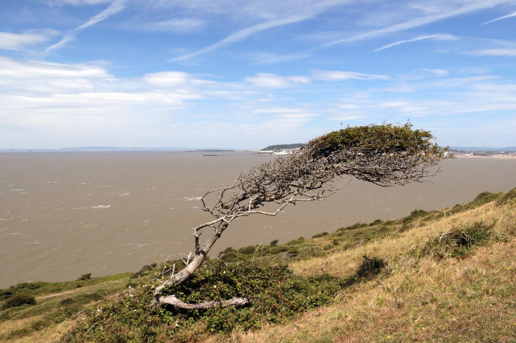
One of the many wind-blown trees on Brean Down, which Geoff described as ‘the Marge Simpson look’
Further information